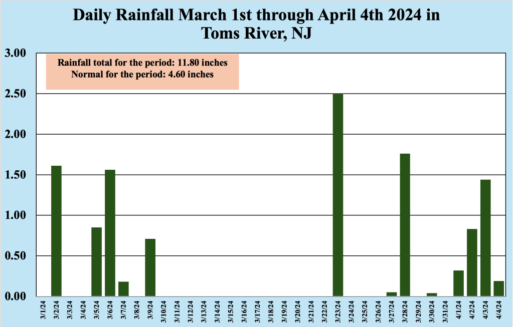
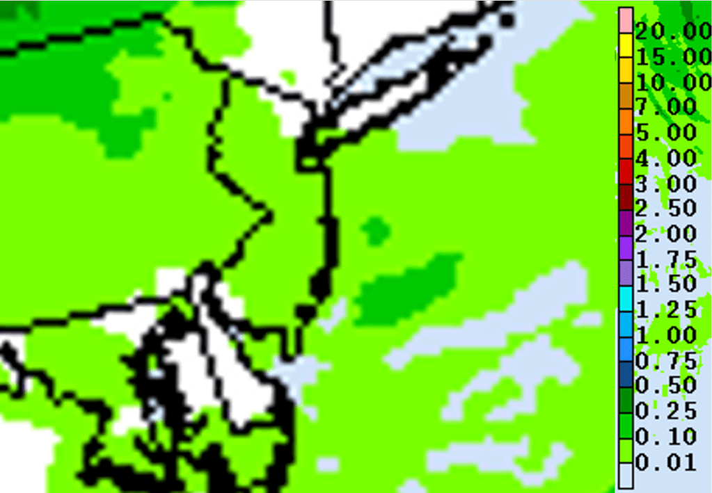
The second half of March into the first few days of April have been more winterlike than springlike, with heavy rainfall and below normal temperatures. Since March 1st 2024, the Bellcrest section of Toms River has received nearly a foot of rain (11.80 inches), with the heavy rain continuing into the first four days of April. However, the overall weather pattern should evolve to look less like winter and more like spring during the next week or so.
During the first four days of April 2024, the atmosphere over the Northeast United States has been somewhat stagnant, with a persistent area of low pressure in the mid levels moving slowly eastward toward the region. Early spring across the US is generally a time of transition, as we exit the winter pattern into one that more closely resembles spring. Most often this occurs first in the mid levels of the atmosphere, where systems become more pronounced, forcing them to slow down.
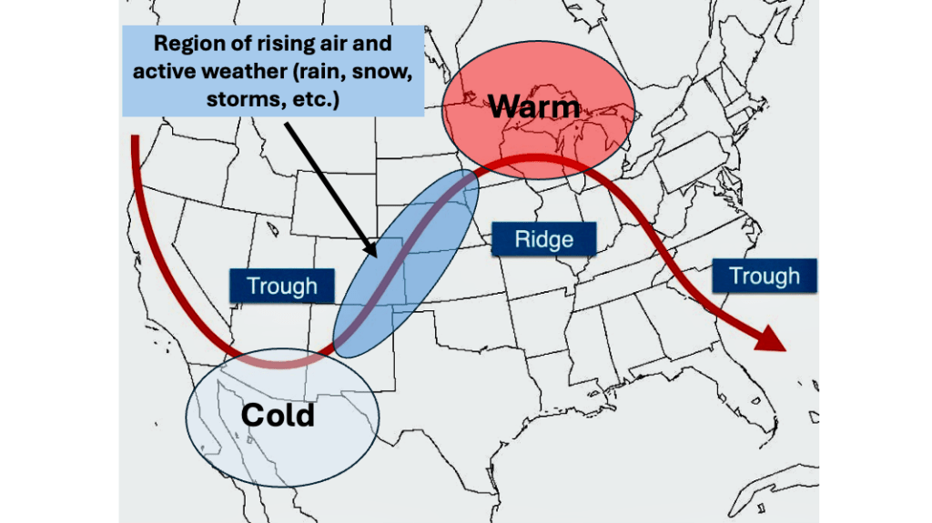
Figure 2 shows what the atmosphere typically looks like at about 18,000 feet above sea level. In this image, we see troughs and ridges, as well as the conditions that are normally expected with them. New to troughs and ridges, or need some more background? Check this out.
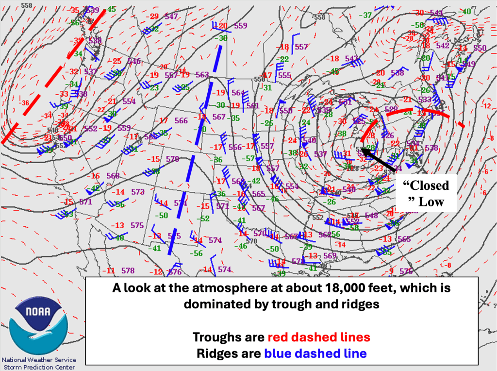
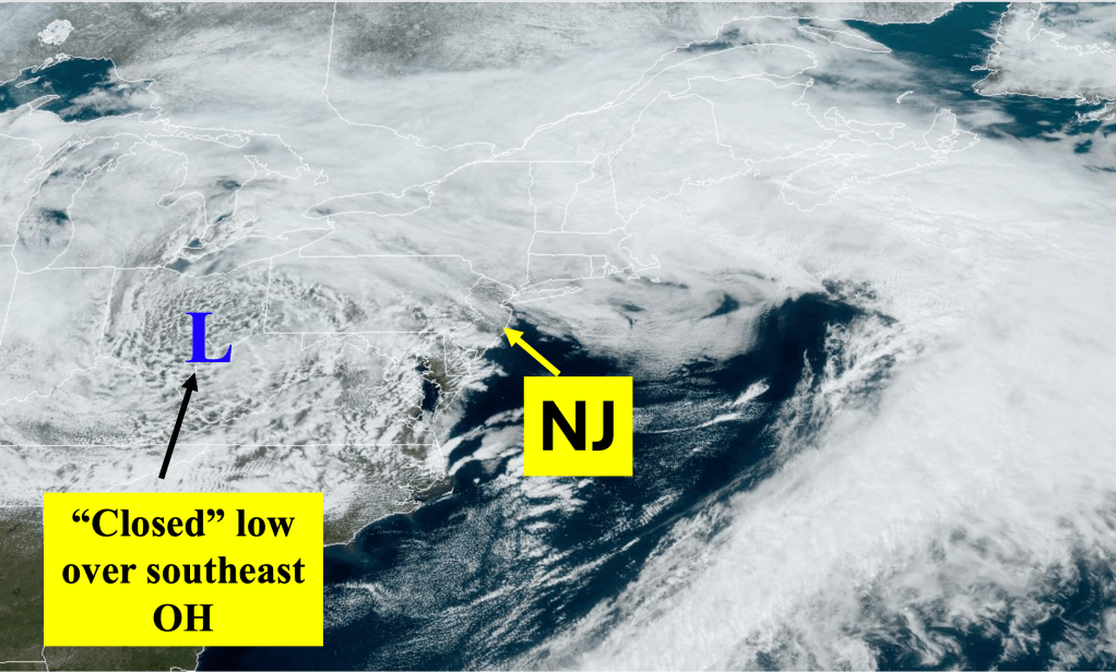
However, the morning of April 4th, 2024 was anything but typical across the US at 18,00 feet. Perhaps the most important (and most noticeable) feature in Figure 3 is the mid level circulation over OH. At this level of the atmosphere, it is unusual to have such a strong system (featuring a closed low pressure system, which is more reminiscent of what you might see at the surface). The closed black lines around the system over OH (called isohyets, or lines of equal heights) show that the system has “closed off” from the normal trough/ridge pattern seen in Figure 2), and that is because the system over OH is much stronger than normal for early April.
Such strong systems are slow to move eastward, as they become stronger. There are no mid level ridges or troughs to the west to keep the system moving (as seen in Figure 2), and these type of “closed” mid level low pressure systems are most prevalent in the spring. At its maximum strength during the morning of April 4th, it should begin to slowly weaken as it moves eastward, supporting snowfall across northern New England as it exits.
As mentioned earlier, because there is not a system to the west (or upstream) of the closed mid level low to cause it to move more quickly, the system will affect the Jersey Shore Friday with scattered showers. During the weekend, skies should become mainly sunny over NJ as the closed low finally exits and a ridge of high pressure develops over the Ohio Valley. Once in place, the ridge of high pressure should persist into at least the middle portion of next week before the next chance of meaningful rainfall for the Jersey Shore.
Looking beyond next week, the overall weather pattern for NJ should be fairly typical for April, with temperatures above normal and rainfall amounts near normal, at least through the middle of the month.

Leave a comment