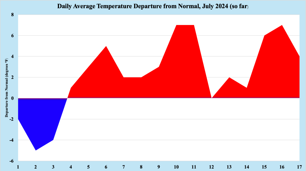
Figure 1 Daily Average Temperature Departure from normal for July 2024, so far
Following what could only be described as a delightful first four days of July 2024 in the Bellcrest section of Toms River, NJ. a well advertised heat wave descended on the Mid Atlantic and Northeast States. Well away from the Jersey Shore, where the low level opposing flow was strong enough to keep the sea breeze at bay, high temperatures during the string of hot and humid days cracked the 100 degree mark, particularly across western NJ and eastern PA.
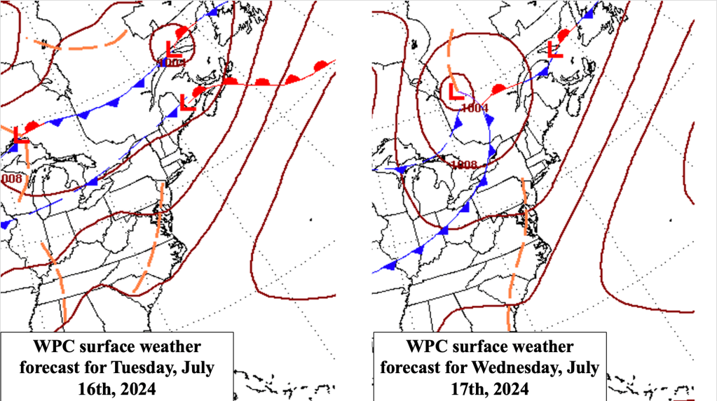
Figure 2 Closer to the coast, the opposing flow was not as strong, along the sea breeze to come ashore. limiting how hot temperatures could get along the Jersey Shore during the event.
Closer to the coast, the opposing flow was not strong enough to keep the sea breeze offshore. For much of the 11 day heat and humidity stretch, high temperatures remained below the 90 degree mark. Toward the end of the streak, the sea breeze remained in balance quite close to our station in the Bellcrest section of Toms River, NJ. As result, the high temperature at our location exceeded 90 degrees for three consecutive days, the technical definition of a heat wave.
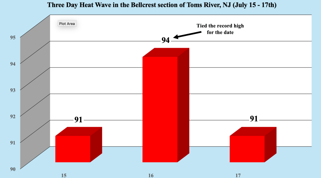
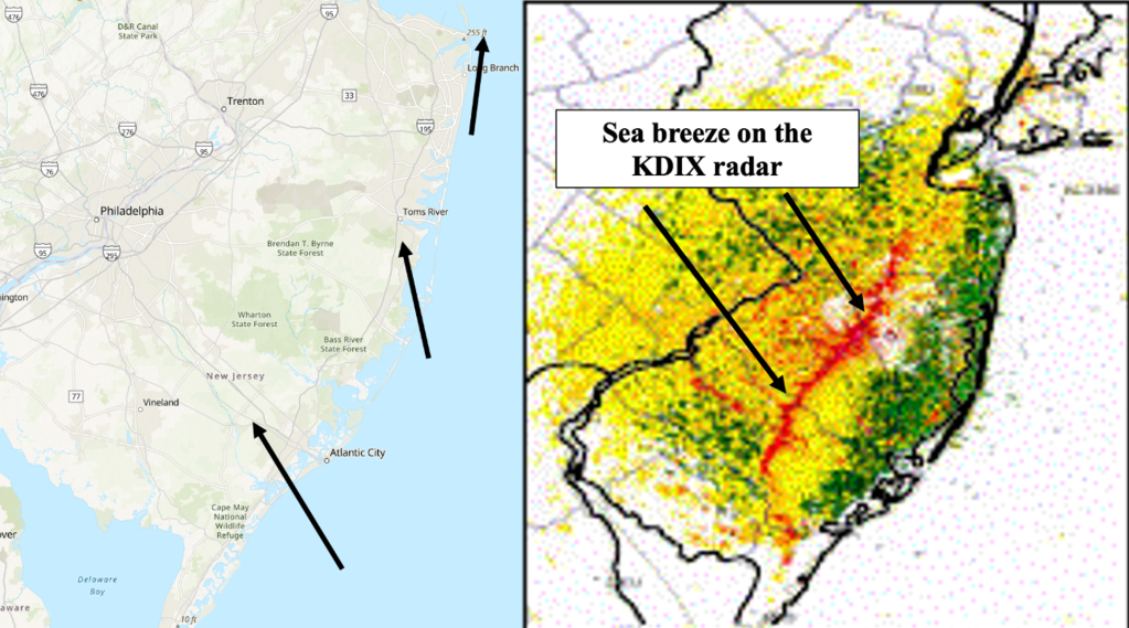
Figure 3 the typical sea breeze configuration along the NJ coast (left), and a good example of the sea breeze as depicted by the DKIX Doppler Weather Radar (right).
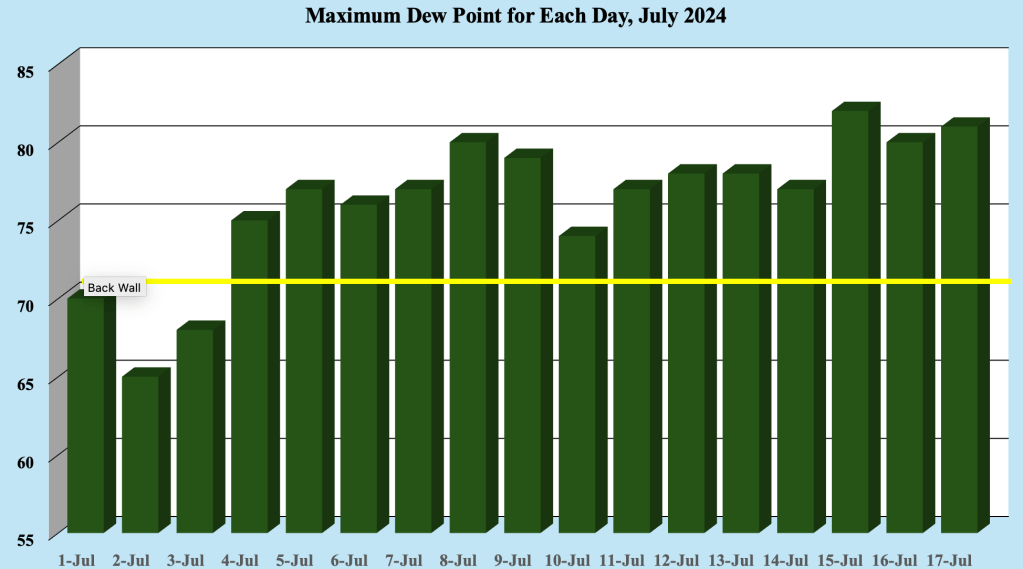
As was the case during the heat and humidity stretch during June 2024, the worst part of the event was not the temperature, but the high humidity and consistent muginess. The maximum dew point recorded by the Davis Weather Station ranged from 75 degrees to 82 degrees, which are impressively high for the coast. The 82 degree dew point values at the end of the heat wave are among the highest we have ever seen, a testament to how oppressive the airmass was for nearly two weeks. In general, dew points of 70 degrees and higher are considered to be muggy, and those values were easily exceeded each and every day.
Cooler temperatures with less humidity can be expected through the end of the week, but there are already indications that dew points may top 70 degrees during the upcoming weekend. suggesting that the mugginess returns. Near normal temperatures are anticipated into early next week, with increasing humidity. Normal highs for the end of July are generally in the mid 80s, so while conditions will be warm, there are not expected to approach the levels seen during the last heat wave.
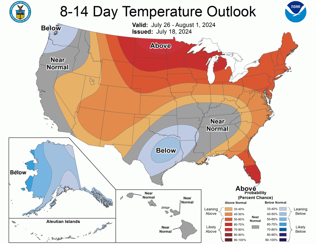
The Climate Prediction Center’s 8-14 Day Temperature Outlook indicates that above normal temperatures return for the end of the month. While temperatures are expected to remain above normal, high temperatures should remain below the sweltering numbers experienced during the middle of the month.

Leave a comment