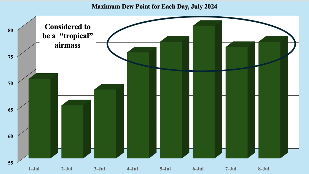
Except for a couple of less humid days near the beginning of the month, July 2024 has been very warm and humid. Figure 1 shows the maximum dew point recorded for each day at our station in the Bellcrest section of Toms River, NJ this month. Generally, any time the dew point rises above 70 degrees F along the Jersey Shore, the airmass is considered tropical, with a source across the Southeast US and the western Atlantic Ocean.
The dew point is the temperature the air needs to be cooled to (at constant pressure) in order to achieve a relative humidity (RH) of 100%. At this point the air cannot hold more water in the gas form. If the air were to be cooled even more, water vapor would have to come out of the atmosphere in the liquid form, usually as fog or precipitation. The higher the dew point rises, the greater the amount of moisture in the air. This directly affects how comfortable it feels outside. The higher the dew point, the muggier it will feel.
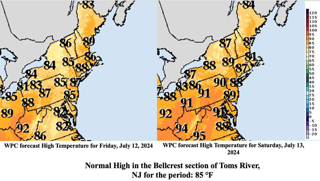
High temperatures along the shore have remained in the mid to upper 80s, as a developing sea breeze keeps the temperatures cooler than nearby areas just inland. However, the high dew points have resulted in quite uncomfortable conditions along the Jersey Shore this week, and that is expected to continue through the end of the week.
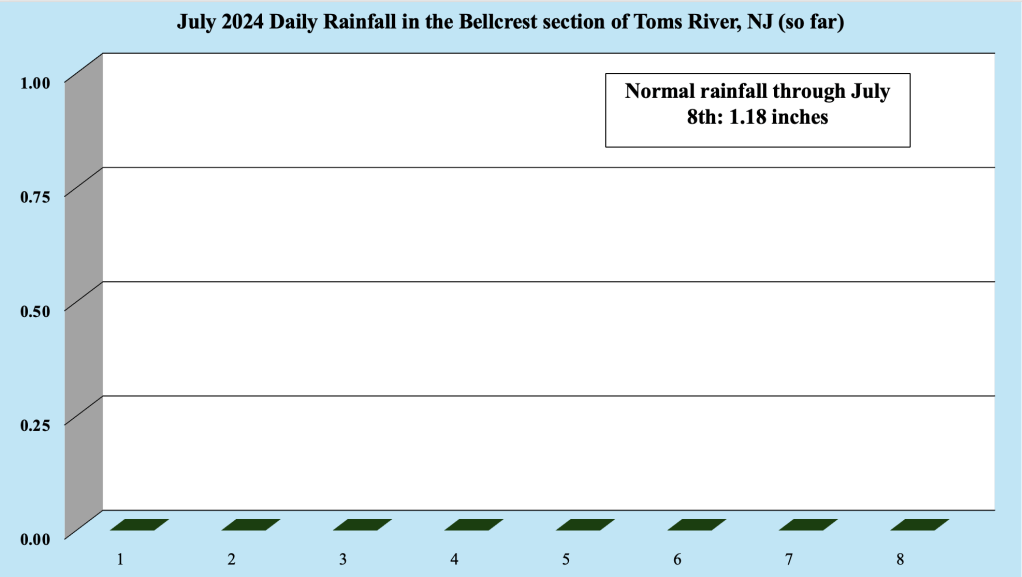
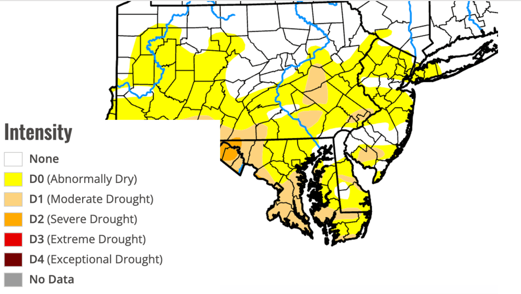
Despite the warmth and humidity, July 2024 has thus far been dry across much of coastal NJ. Some locations has seen scattered thunderstorms with locally heavy rainfall, but many have seen no rain since the end of June. Our station has not received any rain this month, with the latest current rain free streak sitting at eight days. Long rain free streaks have been common this year, starting in March 2024 and continuing in June 2024. Sporadic rainfall has resulted in much of the area being classified as abnormally dry, which is generally not good considering rainfall during the summer months is wholly dependent on thunderstorm activity.
As a frontal boundary approaches from the west late this week, thunderstorm activity is expected to increase along the Jersey Shore. The front weakens as it approach the Northeast and Mid Atlantic, allowing it to slow down. Deepening moisture (high dew points) are expected to focus on the front, feeding the storms. Storms will likely track along the front, allowing storms to repeatedly affect the same areas (called training of storms), which could allow for some impressive rainfall amounts where storms linger longest.
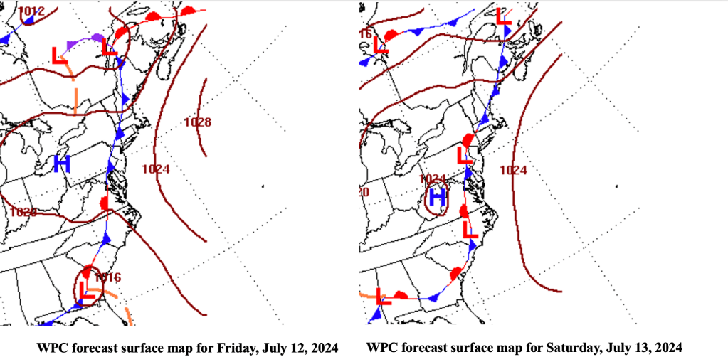
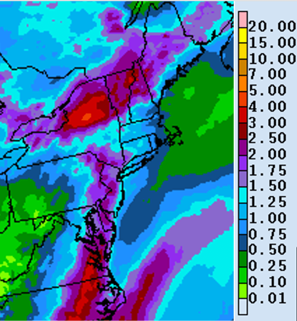
Storms are expected to produce a large swath of 1.50 to 2.50 inches of rainfall Friday into early Saturday, with the heaviest rain expected late Friday afternoon into Friday night. Once again, it appears as though the highest rainfall totals will occur along the I-95 corridor, with lesser amounts along the Jersey Shore itself. However, given the expected amount of moisture in the air, any location could see locally heavy rainfall and possible issues with runoff. Any larger flooding issues appear to be confined to the I-95 area at this time.

Leave a comment