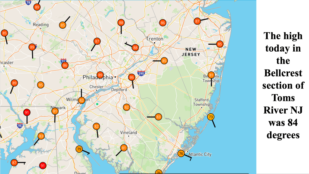
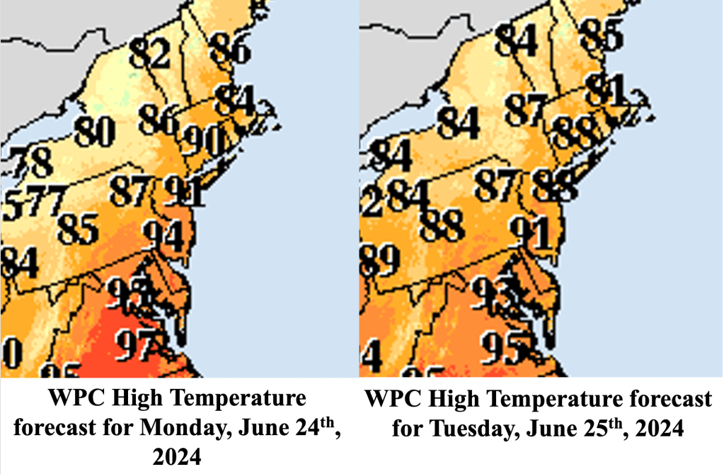
The much discussed heat wave, the first so far this year across NJ, has arrived across portions of the Mid Atlantic and Northeast states. However, along the Jersey Shore, where the opposing low level southwest flow was relatively weak, the sea breeze asserted itself, keeping the warmest air north and west of the Garden State Parkway. The high temperature in the Bellcrest section of Toms River reached 84 degrees, which is above the normal high for the date (which is 80 degrees). Humidity has been increasing, with dew points piercing the 70 degree mark, indicating the presence of a tropical airmass.
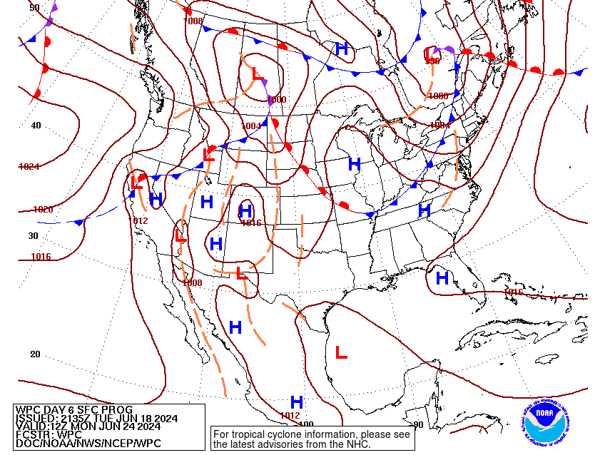
The reason temperatures did not get any warmer along the Jersey Shore was tied to the development and movement of the sea breeze. Since the opposing flow associated with surface high pressure over the Ohio Valley was weak, the sea breeze came ashore unopposed, eventually reaching a position beyond the Garden State Parkway during the afternoon. North and west of the sea breeze, high temperatures managed to crack the 90 degree mark.
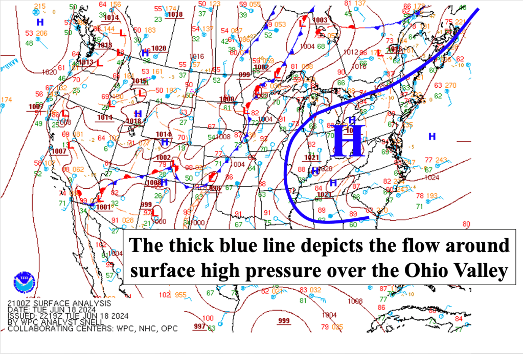
The same basic pattern is expected for the next couple of days, as the opposing flow in the lower levels may not be strong enough to hold the sea breeze at bay, preventing at least some communities on the Jersey Shore from reaching the 90 mark. Humidity will be on the increase, though, and the increase in humidity, coupled with the temperatures, could result in heat index values into the mid to upper 90s, regardless of whether the actual high temperature breaches 90 degrees or not. In fact, it is possible that portions of the Jersey Shore reach 90 degrees only once or twice through the weekend because of the sea breeze. At this point, it appears as though no daily record high temperatures will be set during this bout of heat.
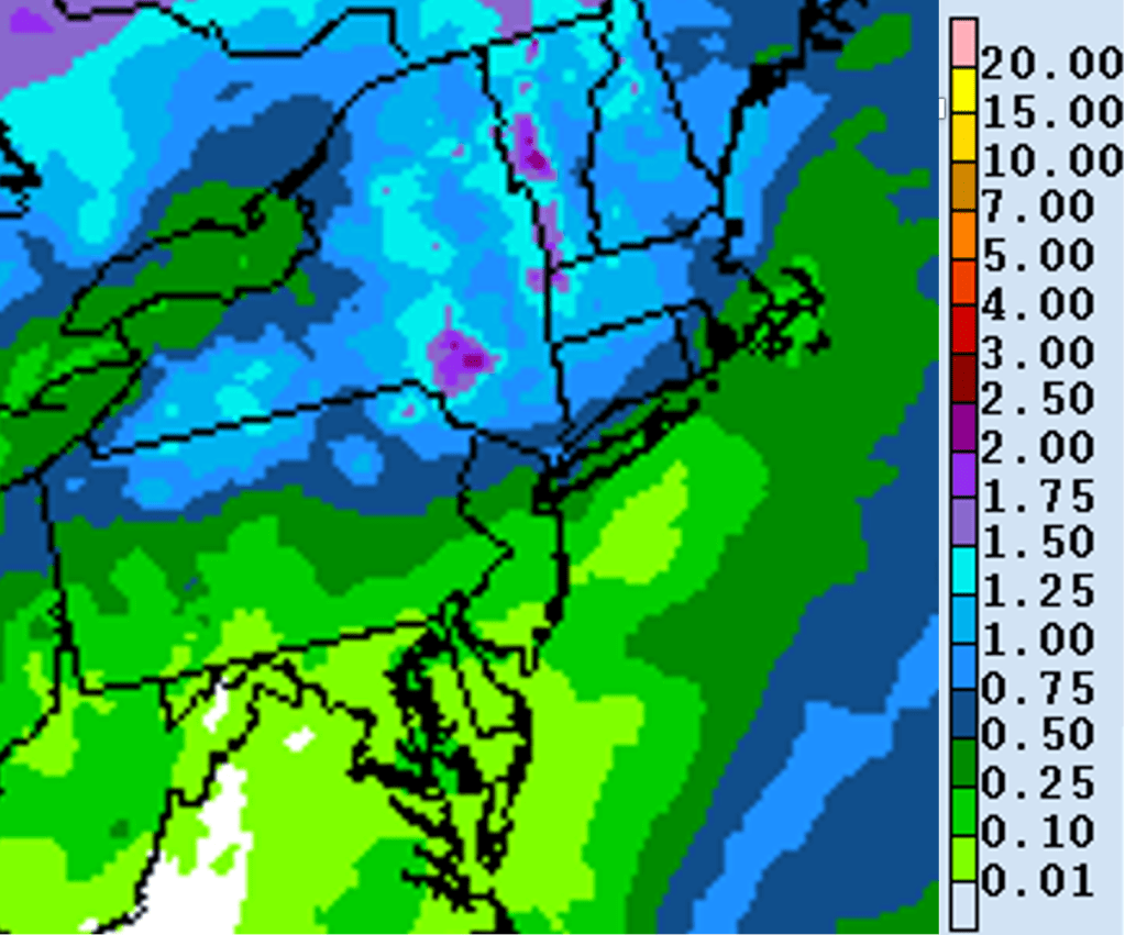
Over the next few days, as the airmass becomes more moist with time, scattered showers and thunderstorms, with the best chances north and west of the Garden State Parkway. Since the overall flow in the atmosphere is relatively slow (which is common with ridges of high pressure in place in the mid levels), some of the storms could produce very heavy rainfall in a short period of time. However, the storms are expected to remain scattered at best, so much places should be dry the vast majority of the time coming up to the weekend.
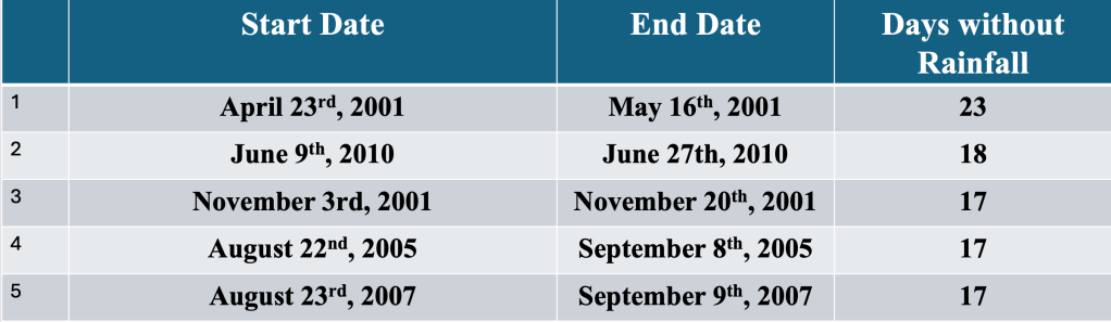
The Jersey Shore has been quite dry so far this month, as the Bellcrest section of Toms River has received about 0.85 inches of rain thus far (normal rainfall amount through June 17th is 2.21 inches). Since that rainfall, we have seen 11 consecutive days of no rain. While the length of that streak is impressive, it is nowhere near the record for June, which is 18 consecutive days set back in 2010. Should most of the storms miss the Jersey Shore into the weekend, it is possible that we could threaten to jump into the top 5 rainfree streaks. The all-time record seems out of reach at this time, as thunderstorms ahead of the next front are expected Sunday into Monday.
A cold front approaching the Northeast Sunday into Monday could provide some relief from the heat, as well as bring the best chance of showers and thunderstorms to the Jersey Shore. Before that time, the highest heat and humidity values are expected, and the best threat for excessive heat is expected along the Interstate 95 corridor Thursday into Sunday. Closer to the coast, temperatures are not expected to be quite as high as further inland, but the combination of heat and humidity could cause issues through the weekend.
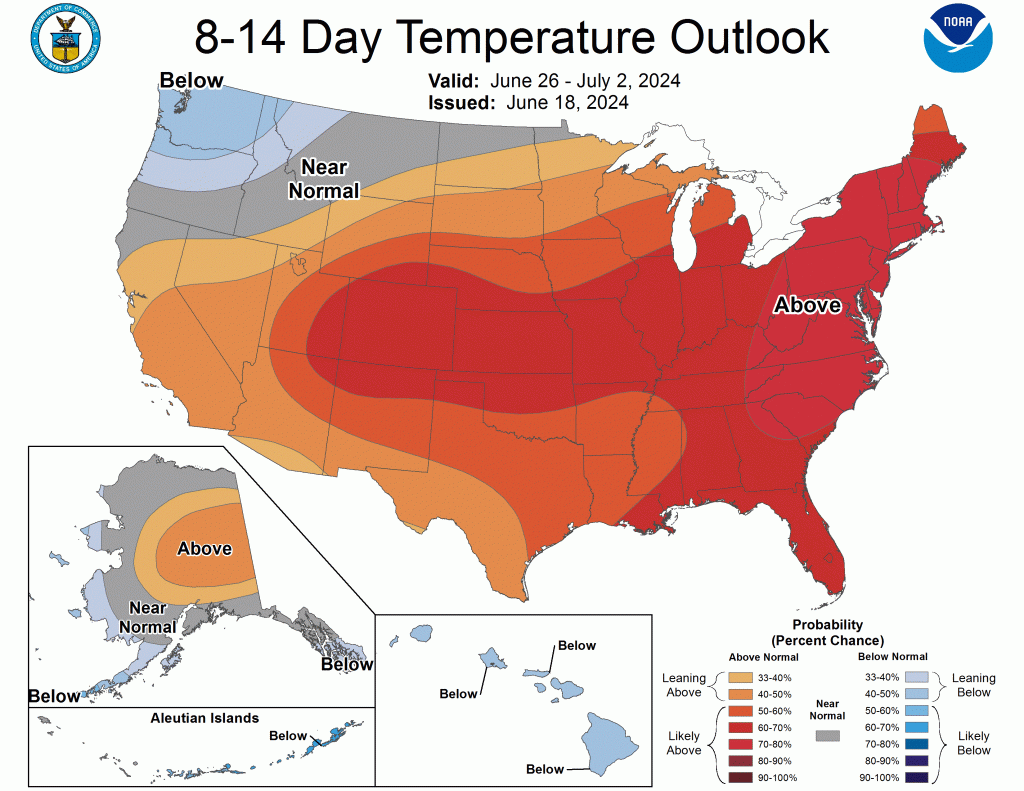
Though a front is expected to drop temperatures during the early part of next week, the airmass change could be relatively slow, and highs could still rise to near 90 degrees even after the passage of the front. In fact, NOAA’s Climate Prediction Center (CPC) is forecasting above normal temperatures to remain in place across the Mid Atlantic and Northeast during the period of June 26th through July 2nd, 2024.

Leave a comment