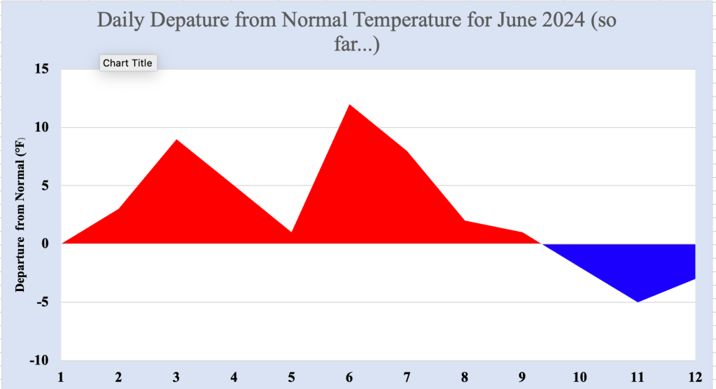
Following about 10 days of above normal temperatures to start June 2024 in the Bellcrest section of Toms River, NJ, a brief cooldown was noted ahead of the next surge of warmth for the end of this week. Once a cold front crosses the region Friday afternoon into Friday night, cooler temperatures are ushered into the Jersey Shore for the weekend, with below normal temperatures and wall to wall sunshine.
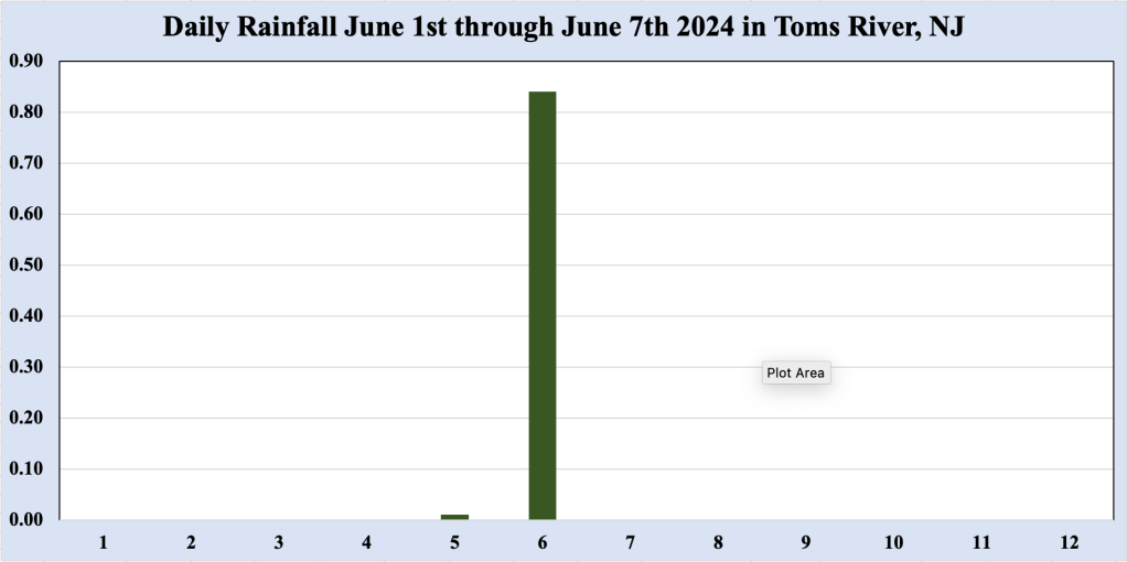
Figure 2 Daily rainfall in the Bellcrest section of Toms River, NJ during June 2024.
June 2024 has also yielded a six day rain free streak, which looks to end as the cold front crosses the area Friday. Rainfall amounts associated with showers and thunderstorms ahead of the front should be close to 0.50 inches. Even with the additional rainfall Friday, rainfall amounts for the month in Toms River would still remain below normal.
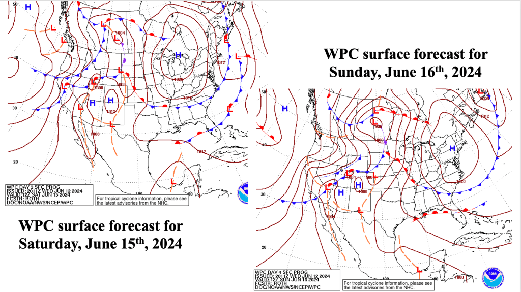
Once the front moves offshore Friday night or early Saturday morning, shower activity should cease, and skies should become sunny for Saturday. Northwest winds could gust during the afternoon Saturday with high pressure heading toward the region, making temperatures in the lower to mid 80s feel a bit cooler. High pressure parking itself over the area Sunday means less in the way of wind, with seasonably warm temperatures to close out the weekend.
High pressure over New England begins to elongate along the East Coast, and the return southwest flow brings hot temperatures back to the Mid Atlantic and Northeast states early next week. As if often the case this time of year, the strength of the low level southwest flow will determine how much of the hot air makes it to the coast. Should the return flow remain strong enough to keep the sea breeze largely at bay, highs could reach into the lower 90s along the Jersey Shore. At this point, it is still too early to tell if the sea breeze offers an effective barrier to the building heat for next week.
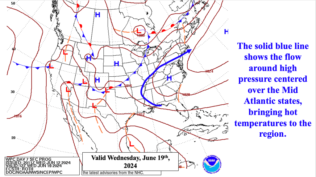
Figure 4 NOAA Weather Prediction Center (WPC) forecast for Wednesday, June 19th, 2024.
As the surface high stretches to encompass the East Coast, it takes on a familiar pattern. Though not quite yet a Bermuda High, its southwest flow will bring with it the threat of the first heat wave of 2024 for much of the area. A heat wave is defined as three consecutive days during which high temperatures reach or exceed 90 degrees. Away from the coast and its sea breeze, it appears increasingly likely that a heat wave will materialize early next week. Closer to the coast and the effects of the sea breeze, it is less clear as to whether the Jersey Shore (particularly east of the Garden State Parkway) will see high temperatures crack the 90 degree mark each day.
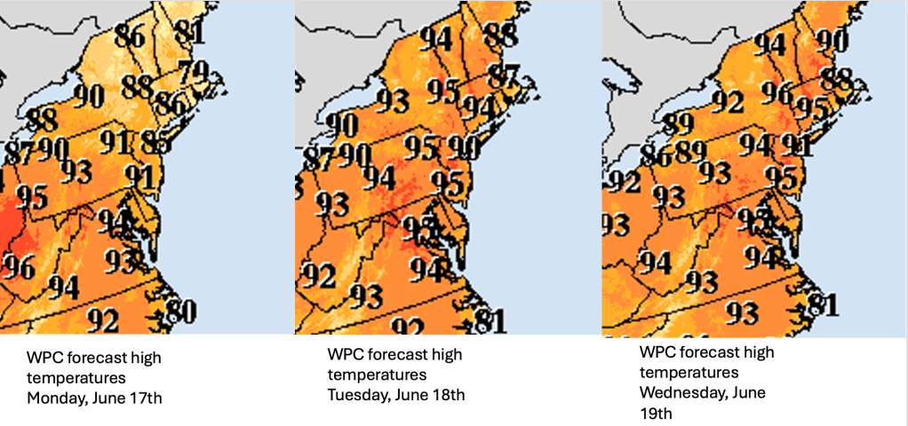
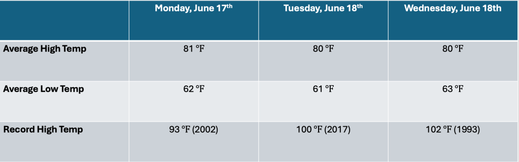
To put these temperatures into perspective for the Bellcrest section of Toms River, normal high temperatures during the early to middle part of next week are generally near 80 degrees. Should the sea breeze be held at bay, the forecast high temperatures would be about 10 degrees above normal. However, high temperatures for each of these three days are generally near 100 degrees (except for the curiously low daily record high for Monday, June 17th, which is 93 degrees set in 2002). While that daily record high could be threatened, the record high temperatures through the middle of next week seem to be out of reach.
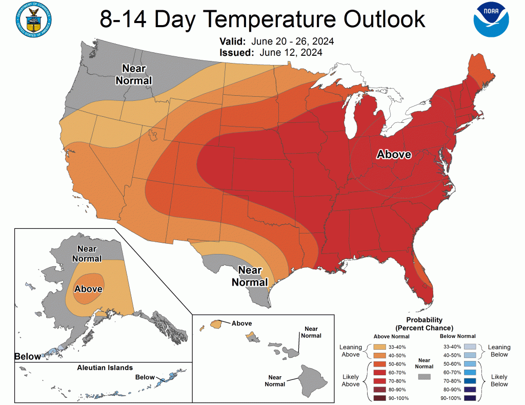
Once the heat settles into place across the Mid Atlantic and Northeast, it appears to remain in place through much of the rest of the month. The most recent Climate Prediction Center 8-14 day Temperature Outlook shows above normal temperatures across the area through June 26th, with the highest probabilities centered near us.

Leave a comment