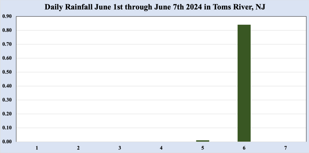
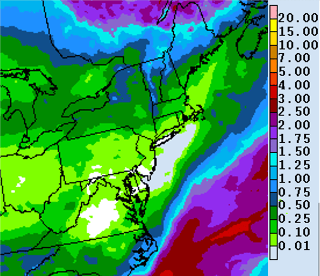
Despite the rainfall of more than three-quarters of an inch received in the Bellcrest section of Toms River, NJ thus far in June 2024, the frequency of rainfall is already behind normal, a trend is expected to continue through at least the first half of the month. As was the case through much of May 2024, the pattern appears as though it will be too fast to allow frontal boundaries crossing the Northeast to funnel sufficient moisture to produce heavy rainfall during the next week or so. In fact, NOAA’s Weather Prediction Center (WPC) indicates that less than 0.25 inches of rainfall is expected along the Jersey Shore through Friday, June 14th, 2024. While there could be a few showers with any one of the fronts, the moisture should remain limited with only light rain showers expected.
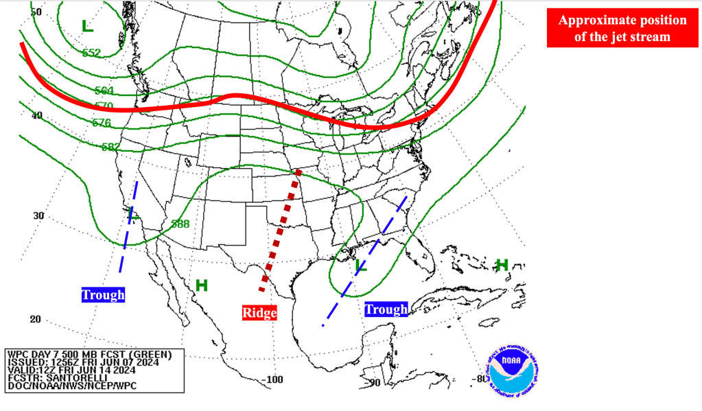
Along with mostly dry conditions, we are expecting temperatures to warm during the middle to end of next week, as surface high pressure settles across the Mid Atlantic states, producing a low level southwest flow that brings the warmer temperatures to the shore. In the mid levels of the atmosphere (where troughs and ridges reside), mid level ridging (associated with warming near the surface) builds east from the Southwest states toward middle of the country, allowing warmer temperatures to reach the East Coast toward the end of next week. Note that the jet stream is expected to remain well north of the region, increasing the potential for above normal temperatures.
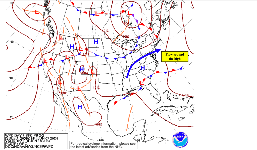
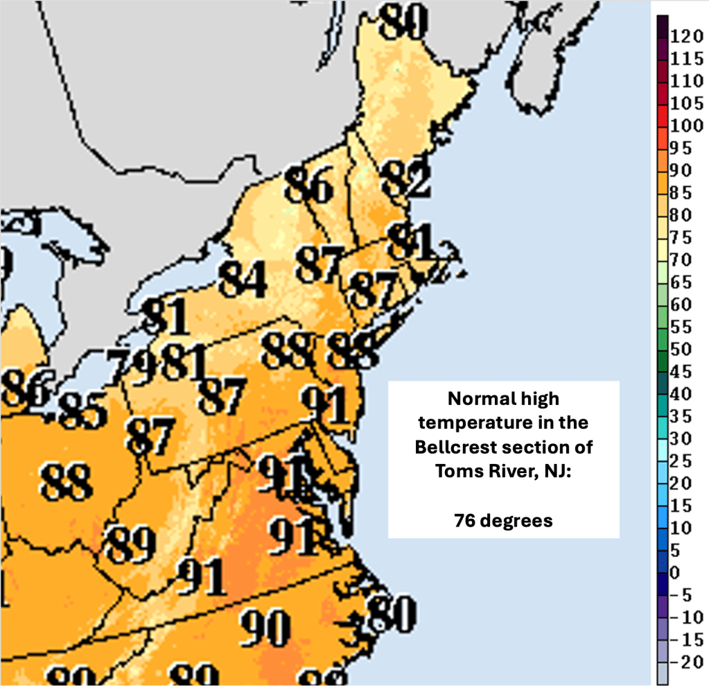
Just how warm temperatures get along the Jersey Shore late next week (and beyond) will depend on wind direction (as it often does). The WPC surface map valid Friday June 14th shows a broad southwest flow around surface high pressure over the western Carolinas. Typically this type of flow this time of year brings much warmer than normal temperatures to the Garden State, with temperatures away from the coast topping out near the 90 degree mark. However, from this distance, it is not clear whether the surface flow near the coast (often referred to as the opposing flow) will be strong enough to keep the sea breeze just offshore. You can learn more about Jersey Shore sea breezes here.
Should the sea breeze remain just offshore, temperatures along the Jersey Shore (particularly west of the Garden State Parkway) could make a run at 90 degrees. If the sea breeze does make it onshore and across Barnegat Bay, temperatures along the Jersey Shore could reach into the 80s, but probably not much more as temperatures over the still relatively cool ocean would preclude 90 degree temperatures near the coast.
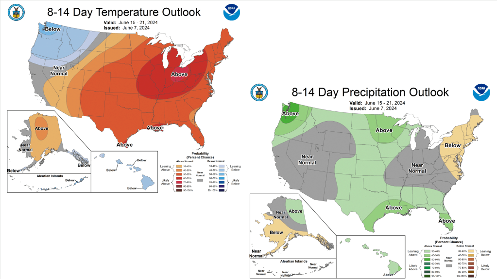
Looking further into the future, mid level ridging attempts to reassert itself across the Southeast states between June 14th and June 21st, 2024, suggesting that we could see the first persistent stretch of above normal temperatures lasting until the first day of summer. NOAA’s Climate Prediction Center (CPC) indicates above normal temperatures through that period. CPC also shows precipitation is expected to continue to remain below normal, as the jet stream remains well north of the Jersey Shore.

Leave a comment