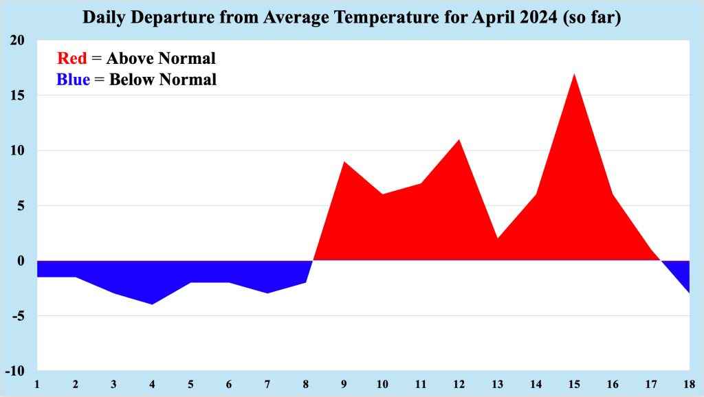
Following a week of above normal temperatures across the Jersey Shore, temperatures dipped back below normal, making conditions feel more like March than April. Though temperatures feel chillier in the wake of the previous warmth, it felt much colder 41 years ago across much of NJ, as winter took one final swipe at the Northeast US. Temperatures at that time felt more like the middle of winter rather than early spring, and the Jersey Shore saw one of its latest snowfalls ever.
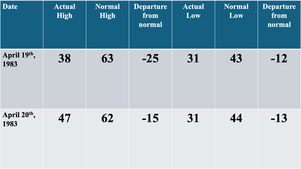
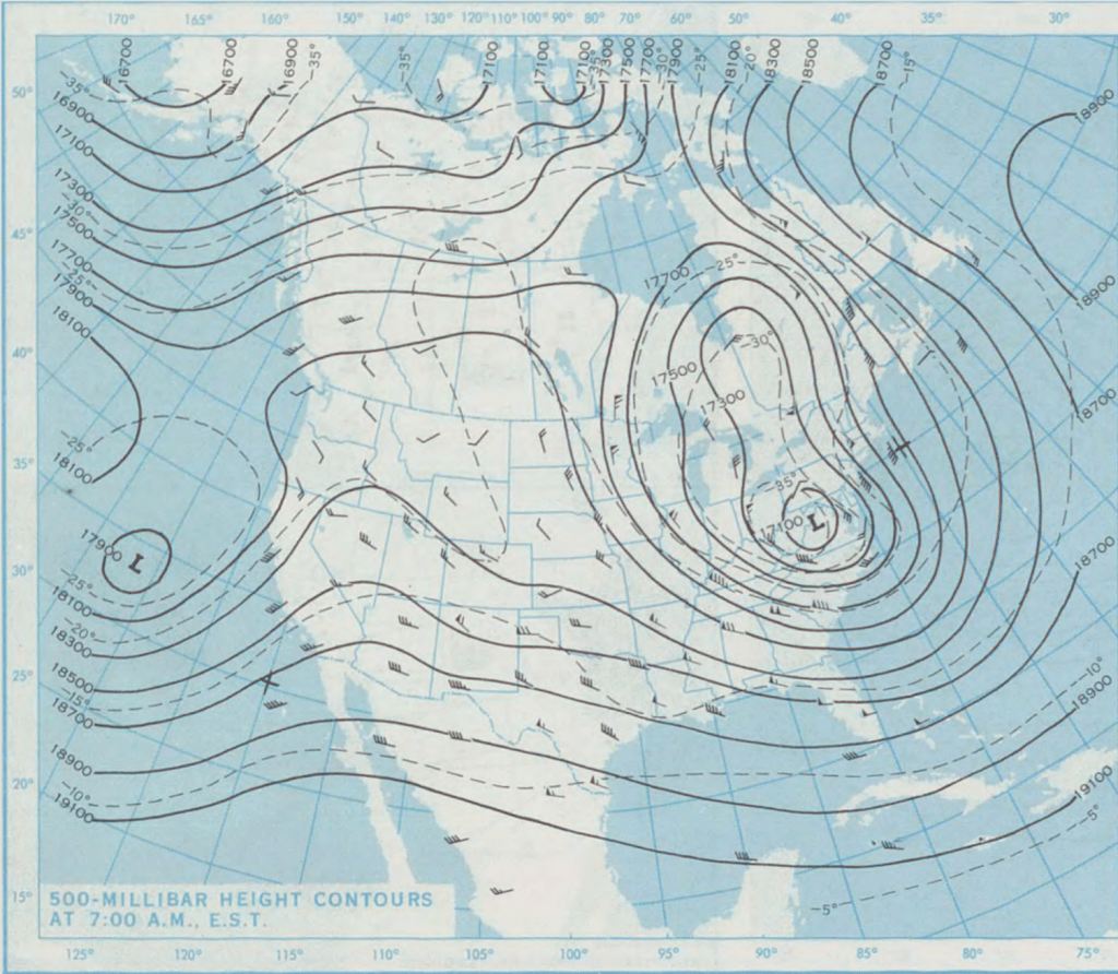
April 1983 began slightly warmer than normal over the Jersey Shore, but a change in the pattern brought cooler temperatures to much of the Northeast for mid month. As it often the case during the spring, the mid levels of the atmosphere has slowed, rather than showing the jet stream moving from west to east across the US. By April 19th, 1983, a closed mid level low had formed over VA/MD, bringing with it much colder temperatures than might be expected a month after the beginning of spring. In the Bellcrest section of Toms River, temperatures were 15 to 25 degrees below normal, feeling more like late February or early March.
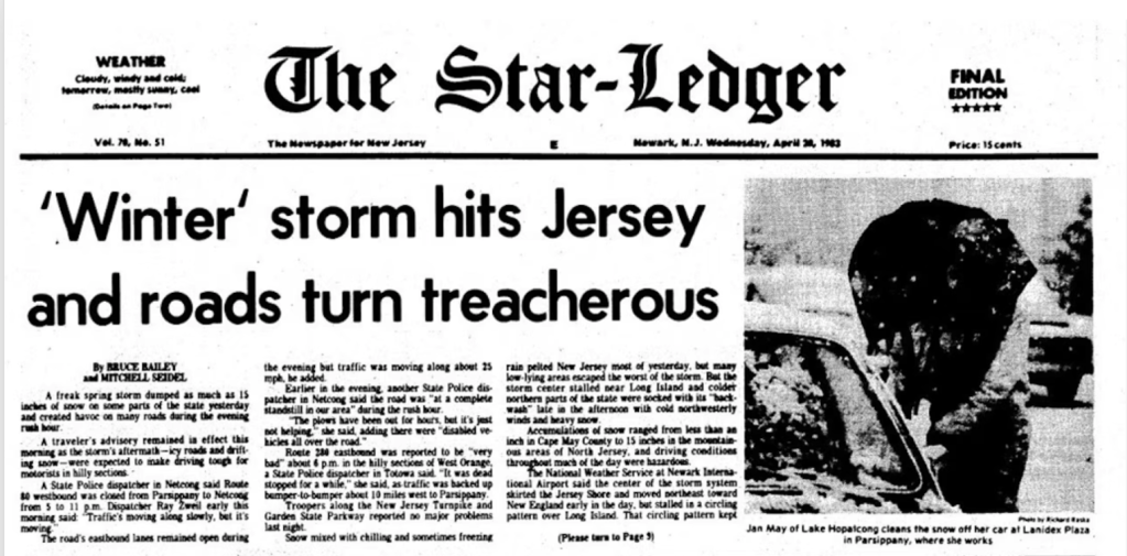
The high temperature of 38 degrees on April 19th, 1983 was the coldest high temperature so late in the season, and established a new record low maximum temperature (often referred to by meteorologists as a “mini max”) for the date. Personal memory of this date recalls a cloudy and cold but windless day, with snow flurries occurring during the early morning hours. Though I was unaware of the details of the forecast for the next 24 hours, a local meteorologist called it a “nightmare” with the potential for accumulating snow. The forecaster admitted he was not sure how much snow would fall on the Jersey Shore since we had not seen snow on the ground that late in the season.
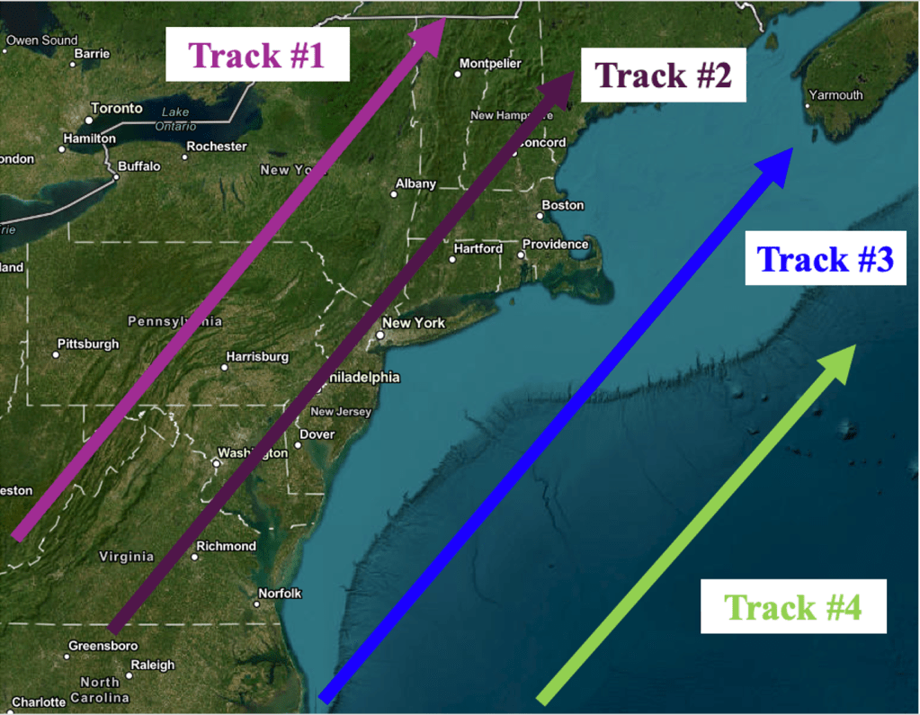
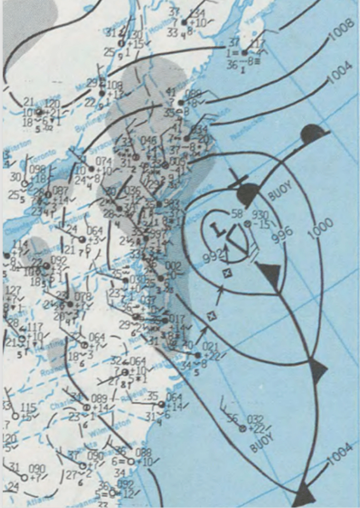
Forecast models were indicating that low pressure would form off the mid Atlantic coast late on April 19th before tracking northeast over the Atlantic Ocean on April 20th. Such a track seemed similar to winter storms tracks that bring heavy snow to the Jersey Shore, but being so late in the season, it was unclear just how much snow could fall during the mid and late portion of April. Perhaps the most important aspect of the storm for snowfall was that the precipitation was expected to fall during the nighttime hours. This timing would mitigate the increasing sun angle, as precipitation falling during the day would almost assuredly fall as rain, giving the warmth of the increasing sun angle.
Like most events late in the season (from mid March forward), the precipitation started as light rain. However, as the intensity of the precipitation increased, the rain changed to snow and began to accumulate, mainly on colder surfaces like grass, cars and fences (you can read more about why rain changes to snow when precipitation intensity increases here). Snow fell for less than six hours, and was winding down at the beginning of the morning commute. Not having a car at the time, I biked to school that morning under cloudy skies with a thin mantle of white covering most colder surfaces.
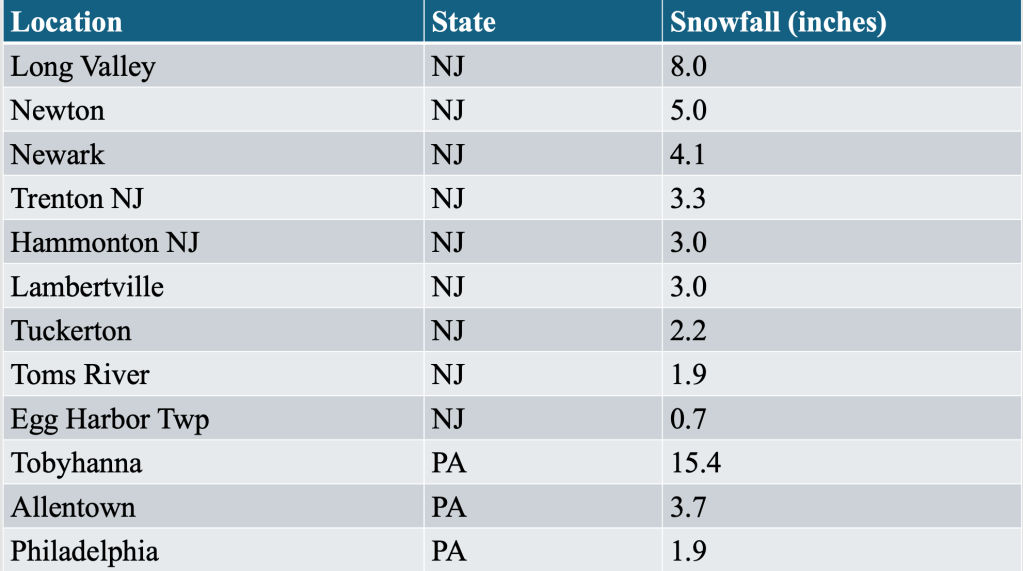
After attending classes in the morning, I biked back home in the early afternoon. By that time, the sun had broken free of the clouds, and the only traces of snow left were in the shadows, out of the reach of the warming late April sunshine. Toms River had received about two inches of snow with this event, but just to the north and west of the Jersey Shore, snowfall amounts increased greatly, topping a foot across portions of northeast PA and northwest NJ. In these areas, snow did accumulate on roads, resulting in mid winter driving conditions for the morning commute.
In my memory, this was the latest I had seen snow accumulation in Toms River (though I did see snowflakes in the air during the afternoon of May 9th, 1977, but that is a story for another time). Given the overall decrease in snowfall in general across the Jersey Shore, it is difficult to imagine snow accumulating across the region any later than this event.

Leave a comment