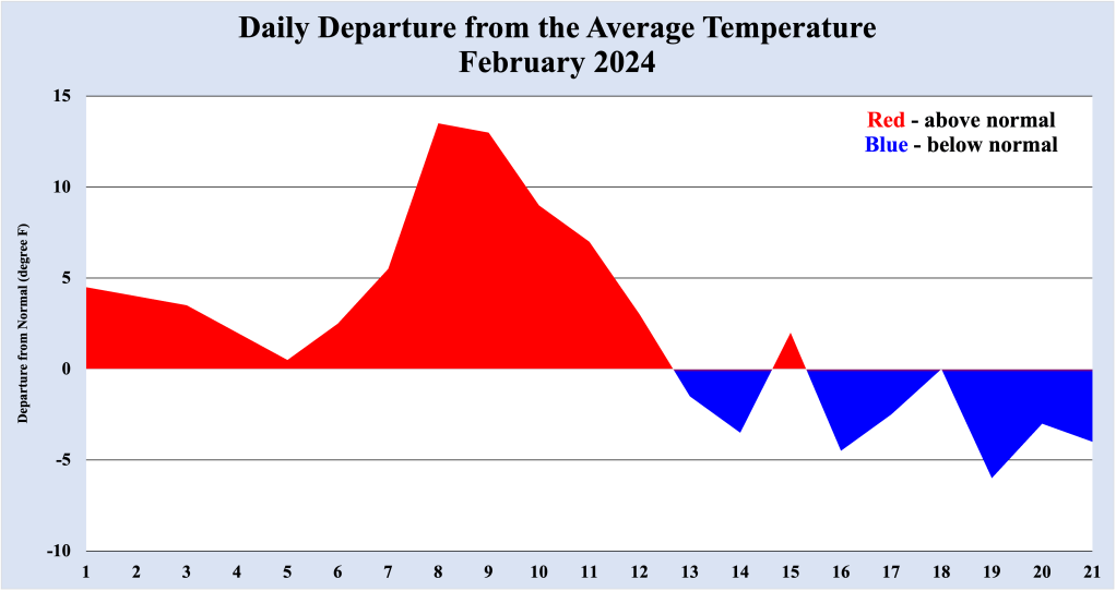
February 2024 saw much above normal temperatures for the first 12 days of the month in the Bellcrest section of Toms River, NJ. However, since that time, temperatures have been consistently colder, with many spots in the Jersey Shore receiving accumulating snowfall. After one more cold shot of air this upcoming weekend, temperatures will rebound, possibly approaching daily record high temperatures territory by next Wednesday and Thursday.
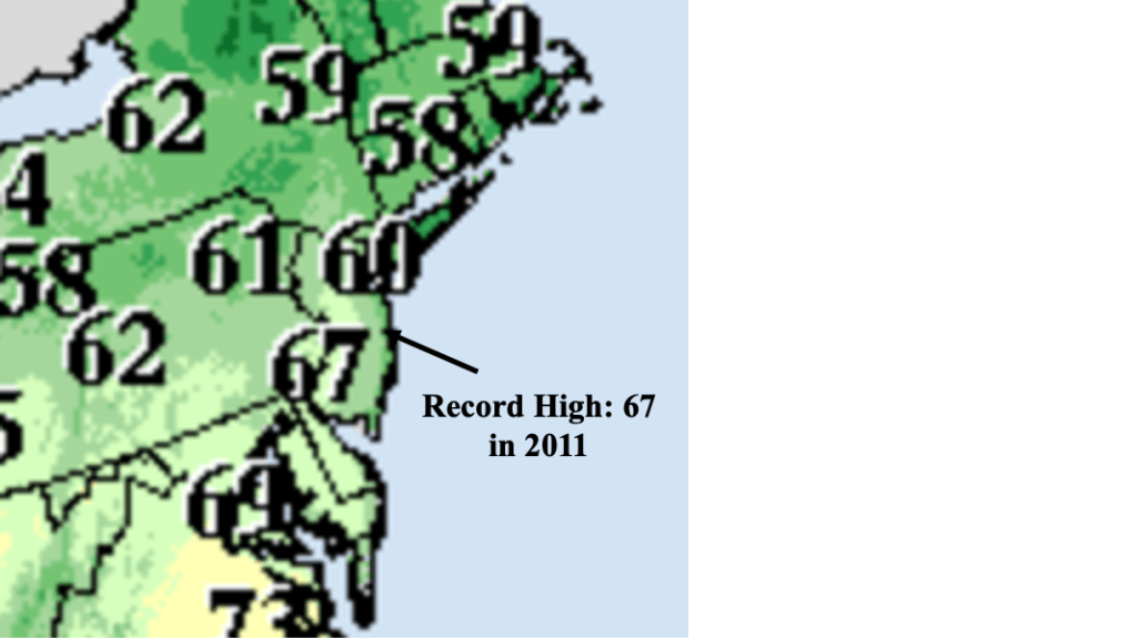
High pressure moving off the Mid Atlantic coast early next week will shift winds to the southwest across NJ, allowing warmer air to return to the Jersey Shore after a nearly two week hiatus. Gusty southwest winds, possibly reaching 35 mph, will allow temperatures to top out in the lower to mid 60s Wednesday. The daily record high in the Bellcrest section of Toms River for Wednesday, February 28th is 67, set in 2011. As long as winds do not back to the south (and allow cooler temperatures from the ocean to move inland), the daily record high for that date should at least be threatened.
A cold front approaches the NJ coast Thursday afternoon and evening. Ahead of the front, a gusty southwest wind will continue to feed warmer than normal air into the region. More in the way of clouds Thursday means high temperatures are not expected to reach the levels attained Wednesday. Still, high temperatures in the lower to mid 60s suggests that the daily record high temperature for that date is not out of reach, but right now it does not appear likely.

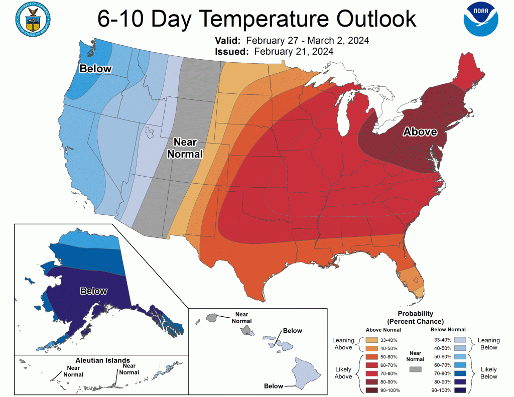
Warmer than normal temperatures are expected to continue across the Northeast US into next weekend, as NOAA’s Climate Prediction Center (CPC) indicates a high likelihood of temperatures remaining above normal through Saturday, March 2nd, 2024.

Leave a comment