Overview
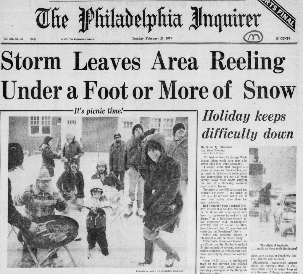
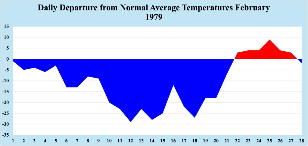
For the second straight year, the Jersey Shore received more than a foot of snow in a storm during the month of February. Unlike the February 6-7 1978 storm, this event was not well forecast, catching many off guard with its intensity and snowfall amounts. Had the storm not occurred at the end of a holiday weekend, the impact on the Jersey Shore could have been far worse. The storm came at the end of a particularly brutal cold snap, during which time temperatures averaged between 20 and 30 degrees below normal for mid February.
Setup before the Storm
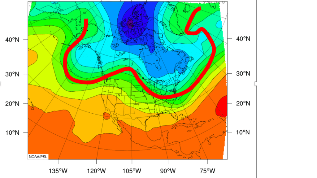
Following a fairly normal early portion of February, the weather pattern turned considerably colder across NJ for the middle of the month. Changes in the orientation of the jet stream allowed Arctic air to slip southward into the Northeast US, dropping temperatures well below normal. During the coldest portion of the Arctic intrusion, (generally between the 12th and the 20th of February), temperatures averaged 20 to 30 degrees below normal! Below zero low temperatures occurred five consecutive days during this streak, with a low of -8 recorded on the 12th. It should be noted that our data archive did NOT include this temperature information. Instead, temperature data from a nearby station in Toms River NJ was used (about four and one-half miles west of our station). While I remember February 1979 as being cold, I was unaware of the extent and magnitude of the cold during the month.
In addition to the cold, February 1979 was dry, with just one snowfall measured before the middle of the month. Computer models were indicating that the cold and quiet February could change in the days leading up to the President’s Day weekend, but there was no clear consensus with respect to a solution. In fact, at one point before the storm, the chances of snow seemed to diminish, enough to allow forecasters to downplay the threat heading into the weekend.
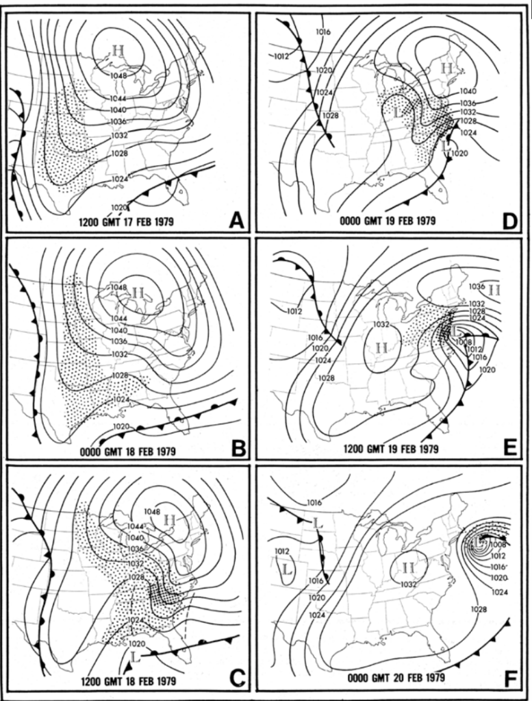
On Sunday, February 18th, 1979, the most reliable computer models at the time indicated that the storm that appeared to pose a threat to the Mid Atlantic Sunday night into Monday was fizzling. Light snow was expected across the Mid Atlantic into southern New England, but models suggested that the storm would not develop quickly enough to deliver a heavy snowfall. That model information allowed forecasters to drop their guard and indicate that the threat appeared to have passed.
The President’s Day Storm of 1979
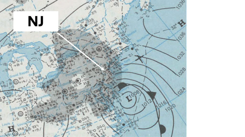
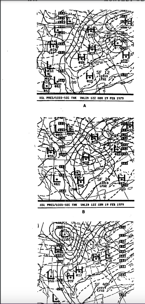
Snow developed during the overnight hours into Monday morning, February 19th, 1979, in response to the surface low. Though the LFM forecast of the position of the surface low was fairly accurate, the developing storm was MUCH deeper than forecast. While the reasons why the storm strengthened so quickly lies beyond the scope of this blog entry, in practical terms the changes that were occurring as the storm was deepening were too complex to model effectively (meaning the model’s ability to track such changes were limited). This same LFM model did an amazing job forecasting both the track AND strength of the Feb 6th/7th 1978 blizzard, but the factors that were important to the development that storm were within the model’s capabilities.
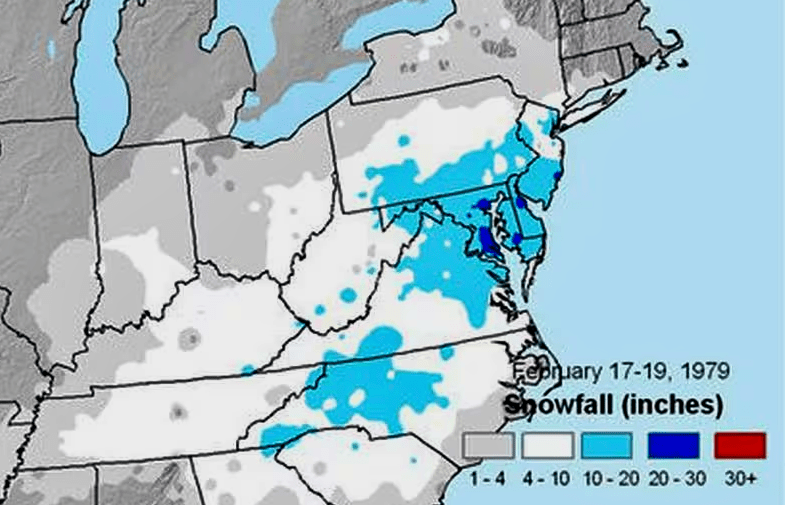
As the storm strengthened quickly during Monday morning, snowfall rates reach 3-4 inches per hour, especially over central and southern NJ. The highest snowfall rates in the Bellcrest section of Toms River NJ occurred in the late morning, as I was walking home with groceries from the store. Warmer air drawn north along the coast fueled the development of thunderstorms just off the NJ coast, allowing for heavy snow to fall for several hours. By the time the storm pulled away from the coast, we measured about 15 inches of snow, most of which fell in a four hour period Monday morning. During this time, the heaviest snow I have ever witnessed in NJ occurred.
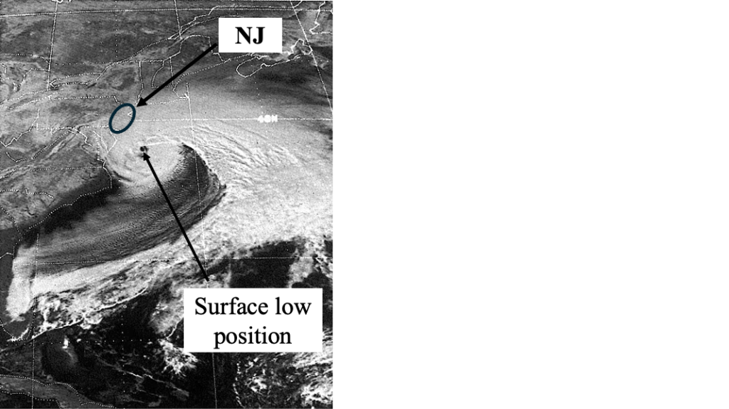
Much of the heaviest snowfall associated with the storm fell across the Washington DC area, where 20 to 30 inches of snow fell during the overnight hours of Sunday night into Monday. Strong high pressure to the north of the storm forced the low to move east, meaning that most of New England received little or no snowfall with this fast moving system. As mentioned earlier, the impact of the storm was mitigated to some degree by its timing; much of the storm occurred at the end of the holiday weekend. Had the storm happened just 24 hours later, the storm could have been crippling, particularly south of the Jersey Shore.
Aftermath
As often happens with late season snowstorms, the storm itself marks an abrupt change in the overall weather pattern, and this storm was no different. Temperatures jumped into the 40s and 50s during the day in the week following the storm, and almost three inches of rain fell in Toms River during the warming period. Following a brief cooldown in early March of 1979, temperatures rebounded into the 60s, bringing an end to the winter of 1978/1979 for the Jersey Shore.

Leave a comment