
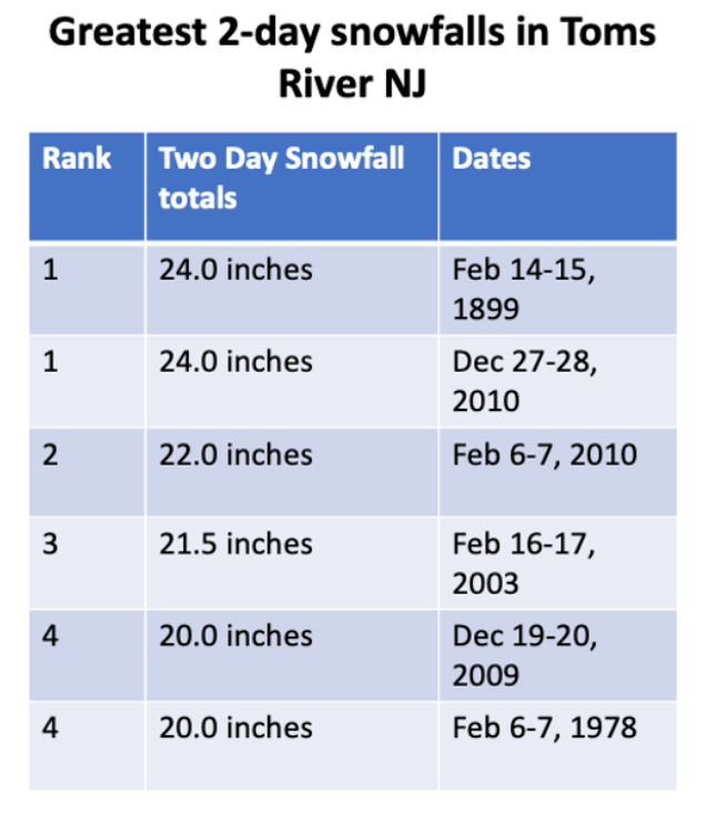
Recent snowfall along the Jersey Shore reminds us that it is indeed still winter, even if temperatures have been above normal for much of the season. While January tends to be the coldest month of the winter for NJ, February is typically the snowiest. Colder ocean water temperatures allows precipitation along the coast to remain snow longer, increasing accumulations. In addition, the temperature differences between the colder interior and milder ocean means that storms are usually stronger, with heavy precipitation, gusty winds and coastal flooding if the lunar cycle is favorable. In fact, four of the six highest two day snowfall amounts in Toms River, NJ have occurred in February, and President’s Days weekends seem to attract storms (including a storm in 1979 that produced 18 inches of snow in 12 hours along the NJ shore).
Setting the Stage
In the week ahead of the storm, temperatures were below normal for mid February along the Jersey Shore. High pressure building across Ontario and Quebec resulted in high temperatures in 20s and 30s, which is about 5 to 10 degrees below normal, and low temperatures in the teens in the 20s. With cold air firmly in place, the Jersey Shore oftens sees mainly snow from storms in February, but there was some model guidance spread on just how much warm air would be injected in the circulation of the system. There was enough spread that most forecasters Washington DC through New York City indicated that confidence for the upcoming system was lower than usual, with the precipitation type near the coast the main issue.

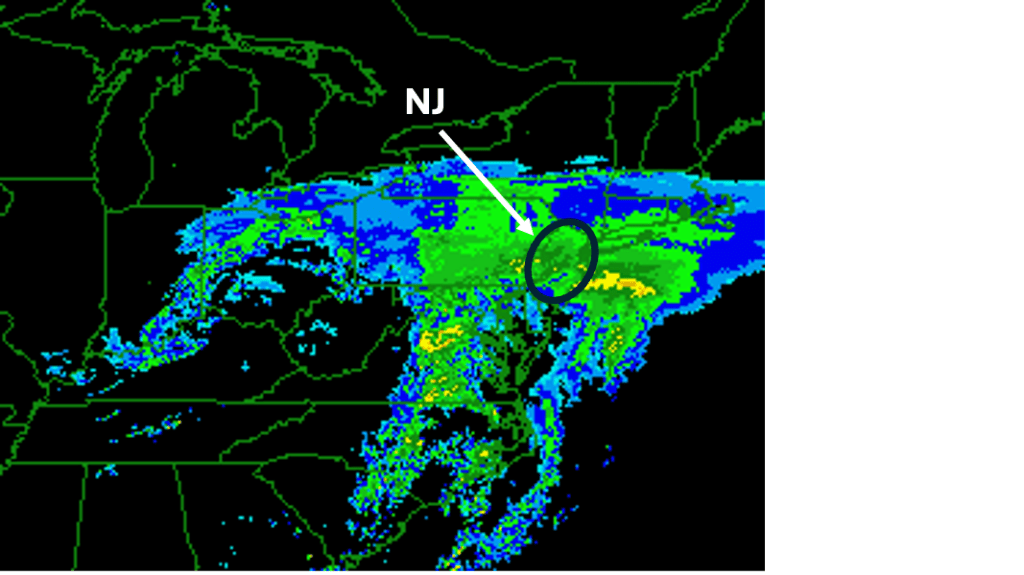
By early Saturday morning, February 15th, 2003, some of the model disagreement had resolved itself, but there was still some question as to whether the Jersey Shore would see a change to plain rain Sunday night or Monday morning as the storm approached the region. Despite the lingering differences, forecasters in the National Weather Service Office in Mount Holly, NJ issued Winter Storm Watches for the entire area to address the potential. Most of the reliable models were showing the storm track closely following a track that typically means heavy snow with little mix with rain for coastal NJ.
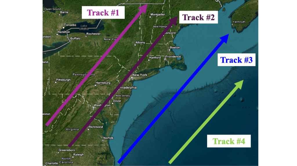
Following Track #3 (blue) almost always ensures that precipitation along the immediate coast remains snow, and often delivers the greatest snowfall amounts. However, there were still questions in the best model solutions that indicated that warmer air would move westward from the ocean to the coast on an increasing easterly wind. This lingering doubt led forecasters to keep snowfall amounts along the NJ coast, even as it became clear that the rest of the area would see one to two feet of snow with this storm. Winter Storm Warnings were issued Saturday afternoon for the Sunday into Monday morning, when the heaviest snow was expected.
The Blizzard of February 2003
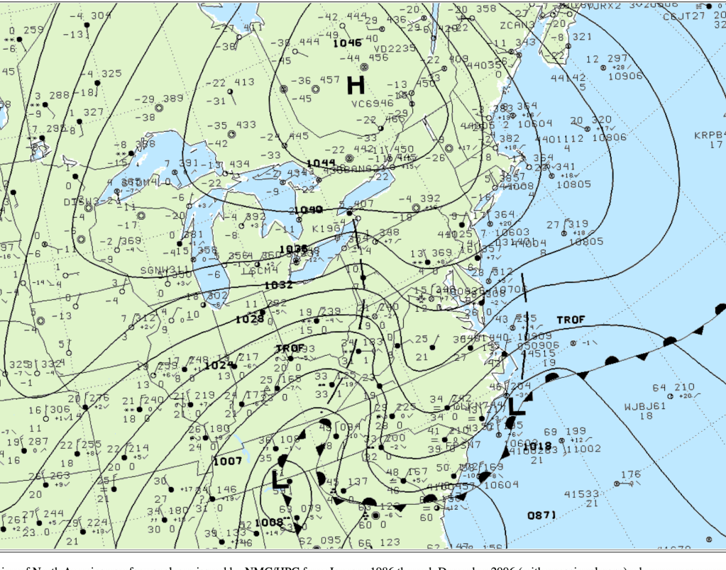
Sunday morning, February 16th, 2003 dawned cloudy and cold along the NJ shore. Strong high pressure over Quebec fed cold air southward into the Mid Atlantic coast (note the surface temperatures near -40 F over Quebec). Not only does the high pressure system position indicate that cold air would be available for the storm, but it also keeps the surface low “tucked” close to the coast, meaning that the storm itself would not go out to sea and miss the region. In fact, the incipient surface low is shown off the NC coast in this image.
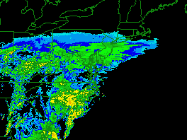
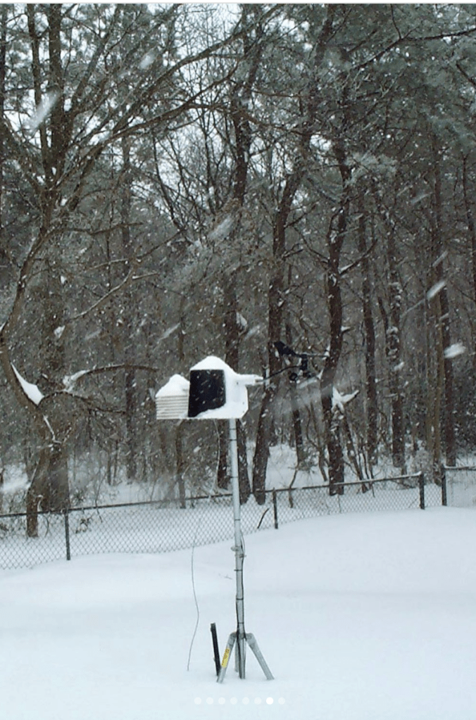
Most of the model differences indicating a change to rain along the coast had evaporated. By this time, model forecasts indicated the potential for one to two feet of snow over much of the region, including the Bellcrest section of Toms River. Light to moderate snow streaked northeast into NJ during morning hours, and banded snowfall occurred during the afternoon and evening, producing more than a foot of snow over much of central and southern NJ.
As the surface low pressure system off the NC coast deepened and tracked to the northeast, winds increased and shifted to the east along the Jersey Shore. Typically when winds shift to the east, rain creeps ashore from the ocean, cutting down on snowfall amounts in places like Toms River, NJ. In this instance, even temperatures over the ocean remained below freezing, so the heaviest precipitation fell in the form of snow, when rates reached 2 to 3 inches per hour during the overnight hours. In addition, the strengthening onshore flow resulted in moderate to major coastal flooding.
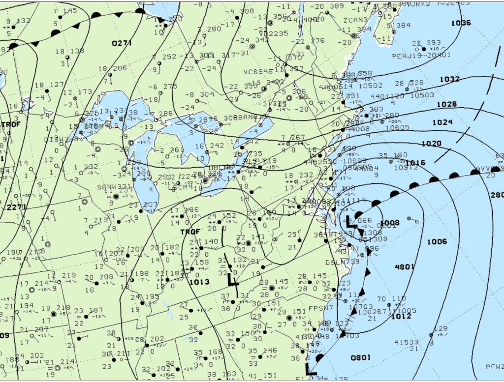
The surface low passed to the southeast of the southern NJ coast Monday morning, and the snowfall rates started to slacken. By that time, many places in NJ has accumulated between 18 and 24 inches of snow, with some of the highest amounts near the coast. As the low pulled away, the snow ended during the afternoon hours, but the strong northeast winds continued to produce blowing and drifting snow.
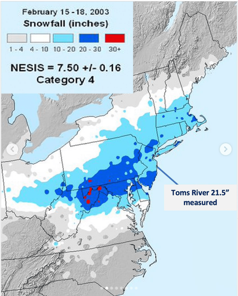
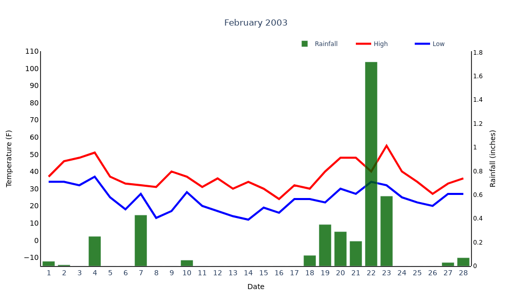
The Bellcrest section of Toms River NJ received 21.5 inches of snowfall during this event, as we had an observer available throughout the event. Putting this event into perspective, the 21.5 inches of snow that fell is still the third highest two-day snowfall total for that location. It is topped by two other February events (February 14/15 1899 and February 6/7 2010), a nod to how snowy this month can be along the NJ shore.
Unfortunately for me, I was working in southern ME during this storm. While we did see snow with this system, the amounts paled compared to what was received in NJ. A recent member to the family struggled to make his way through the snow in his backyard, and this could have been the first time he saw snow!

Epilogue
In the wake of the President’s Day Blizzard of 2003, temperatures in the Northeast warmed well above freezing. Just five days after the storm, more than two inches of rain fell into the deep snowpack, resulting in river and small stream flooding away the NJ coast. Behind the wet system, temperatures dropped below normal as winter held on into early March.

Leave a comment