Following a stretch of dry and seasonably cool temperatures during the first week of February, warmer temperatures are on tap for this weekend, and wet conditions follow early next week. Beyond that, there are indications that winter will make a strong comeback across the Jersey Shore, with the potential for snow during the President’s Day weekend.
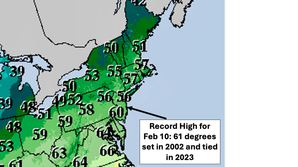
Following a week of mostly dry and seasonably cool temperatures during the first week of February 2024, changes are coming for the Jersey shore through the weekend and beyond. As high pressure moves off the Mid Atlantic coast, the return southwest flow brings milder temperatures into NJ for the weekend. Highs in the 50s and lower 60s (which is 10 to 15 degrees above normal for mid February) could result in near record temperatures. In the Bellcrest section of Toms River, NJ, the daily record high temperature on Saturday, February 10th is 61 degrees( first set in 2002 and tied just last year). This value could be approached, particularly if there is any sunshine early in the day.
A weak cold front crosses the Jersey Shore Saturday night into Sunday, and a few showers could accompany the front. Despite the frontal passage, high temperatures on Sunday could reach back into the 50s along the Jersey shore, which would be 10 degrees above normal. However, the daily record high temperature for Sunday, February 11th in the Bellcrest section of Toms River is 68 degrees, set in 2009. This value appears to be out of reach.
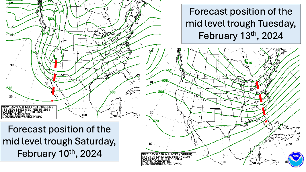
Behind the cold front, the mid level weather pattern begins to change, bringing the potential for colder and wetter conditions, starting early next week. Figure 3 shows the forecast position of a trough in the mid levels on Saturday, February 10th. This trough, the last of the atmospheric river that devastated southern California this week, tracks from the Desert Southwest Saturday to the East Coast Tuesday, February 13th. Weather often begins in the mid levels of the atmosphere (at about 20,000 feet) and works its way to the surface. This is why tracking troughs and ridges in the mid levels of the atmosphere is so important to weather forecasting. Confused about troughs and ridges in the mid levels of the atmosphere? Fear not; I covered this topic in a previous blog. If you are interested in troughs and ridges, check out this link.
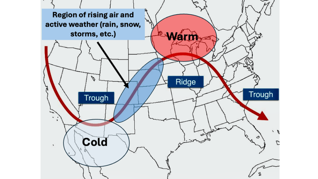
As the trough moves east, colder air and moisture travel with the trough, and low pressure is forecast to develop over the Southern states head of the trough. Low pressure systems often form ahead of mid level troughs in the region of rising air (as depicted in the image in Figure 4). The developing low is expected to track off the Mid Atlantic coast Monday into Tuesday, bringing with it colder temperatures and rain for the Jersey Shore.
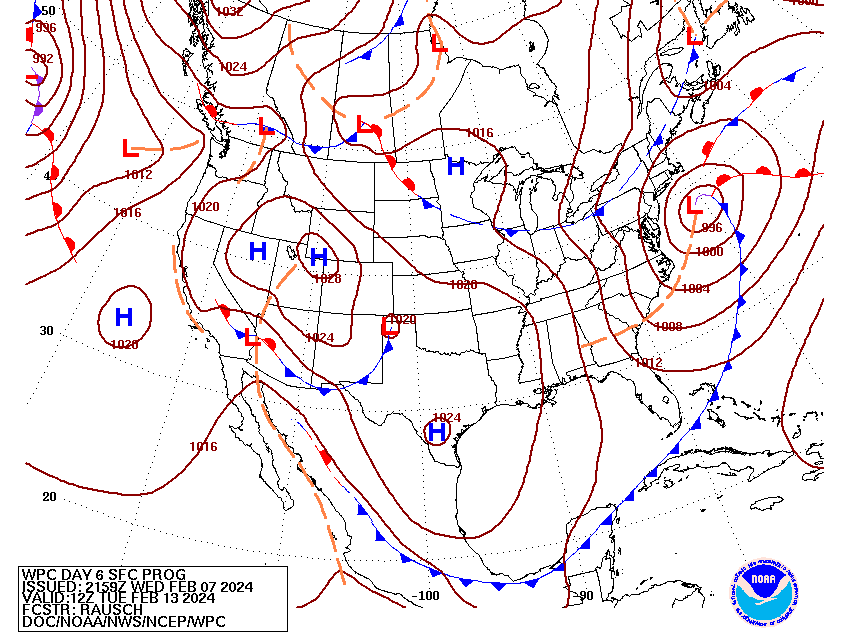
The Weather Prediction Center track for this low pressure system would appear to be favorable for heavy snow along the Jersey Shore. Unfortunately for snow lovers, temperatures near the surface ahead of the low pressure are expected to be too warm for snow, so a cold rain appears to be in store for the coast. The low pressure system and colder temperatures associated with it mark a return to a more winter like pattern for much of the Northeast starting in mid February and possibly lasting into early March. Some of the better medium range weather models suggest that a strong low pressure system could affect the Jersey Shore during the President’s Day weekend.
Stay tuned.

Leave a comment