Overview
Before the advent of satellite images and automated surface observations, weather observers would identify the types of clouds in the sky, as well as their height as part of routine weather observations. Identifying the types of clouds can provide information on what is occurring in the atmosphere in that location. In the 1930s, the National weather Service (known then as the Weather Bureau) developed charts describing the state of the sky, which aided forecasts in determining the state of the atmosphere at standard times throughout the day and night.
During my days as a weather forecaster, my first rule of forecasting was simple: look out the window. Knowing what is occurring now can give an observer (or a forecaster) a good idea what might happen in the short term (during the next few hours). For example, if I saw altocumulus castellanus in the sky driving into work in the morning during the summer I knew we would have a busy afternoon and evening with thunderstorms. This cloud chart was developed from the NWS chart, augmented by my experience with the different cloud types, punctuated by pictures of each type taken by myself for my brother.
There are three clouds categories outlined in the chart: Low clouds, Middle clouds, and High clouds. Clouds at each level of the atmosphere can yield clues as to what is occurring now, and what might happen in the future.
H1 – Wispy cirrus
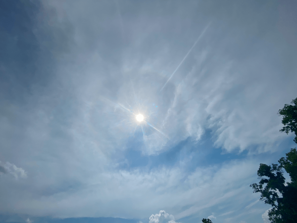
Cirrus clouds are generally composed of ice crystals and found between 20,000 and 60,000 feet. Cirrus is usually white, as the cloud have undergone glaciation, a process in which any supercooled water droplets are transformed into ice crystals. However, depending on the thickness of the cirrus and the angle of the sun, cirrus can appear to be darker, or even contain “sun dogs”, circles with rainbow like colors.
Strands, hooks or filaments of cirrus clouds indicate the presence of a local jet streak, or the general direction of the wind flow at the levels of the clouds. These clouds appear during fair weather and are not generally associated with precipitation in the near term. This image shows filaments of cirrus over the Cahokia Hills located in Collinsville, IL.
(Photo credit: Jeff Hayes)
H2 – Dense cirrus with puffs and wispy edges

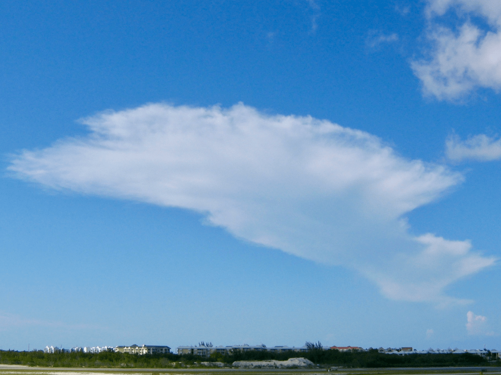
Unlike typical cirrus, these cirrus clouds are thicker, often appearing with white puffs along with wispy edges. The thickness of the cirrus indicates deep moisture in the higher levels of the atmosphere. Occasionally these cirrus clouds are the remnants of cumulonimbus clouds (CB), typically after the CB has dissipated.
In this image (taken over TD Bank Park in Somerset NJ), the cirrus presents both puffs and tufts. Normally these features would appear white, but the setting sun produced vivid colors through the fibrous high clouds. Seemingly not associated with any leftover CB clouds. the cirrus here appeared to reflect the copious amount moisture high in the atmosphere.
(Photo credit: Jeff Hayes)
H3 – Dense anvil shaped cirrus, originally the remains of a CB cloud
Once the upper part of an cumulonimbus (CB) clouds, these cirrus are the dense anvil shaped remains. As the anvil dissipates, the anvil is left behind. Though they can maintain their shape for a time after the dissipation of the CB, these clouds gradually spread out and dissipate.
Across the Northeast, it is uncommon to see this type of cirrus, as trees and other clouds often obscure the sky when thunderstorms are present.
H4 – Cirrus increasing

Cirrus clouds are generally composed of ice crystals and found between 20,000 and 60,000 feet. Cirrus is usually white, as the cloud have undergone glaciation, a process in which any supercooled water droplets are transformed into ice crystals. A general increasing in coverage of cirrus, as well as thickening, can indicate the approach of a cold front or area of low pressure, portending the eventual arrival of precipitation.
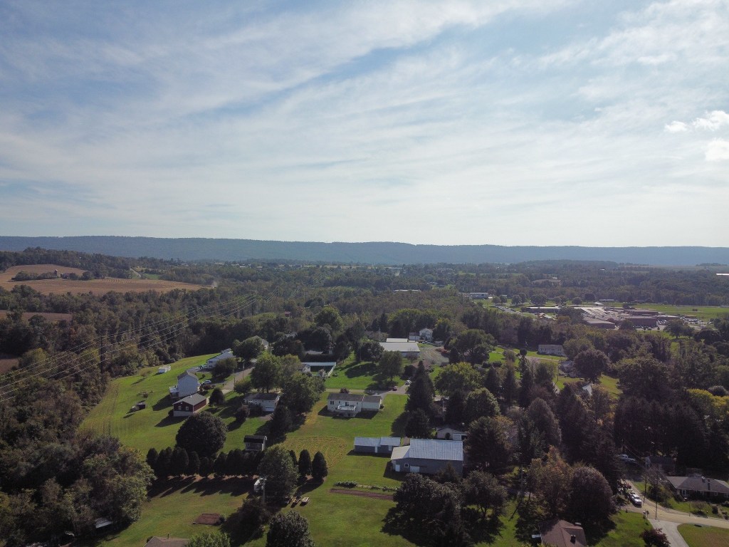
However, thickening cirrus can simply indicate a patch of moisture linked to a mid-level trough. In this case, the clouds generally pass with no adverse weather associated with them. In this image, captured over Skyline View, PA, the increasing and thickening cirrus was not a precursor of any significant weather, but did result in a spectacular post sunset view
H5 – Increasing cirrus less than half of the sky
Cirrostratus clouds often varying in thickness, can cover large areas, and unlike cirrus, have sharpness only on their edges. Occasionally cirrostratus is thick enough to obscure the sun or the moon, and light scattered by ice crystals can result in “sun dogs”, a circle of rainbow-like colors.
These clouds indicate large areas of moisture in the high levels of the atmosphere, possibly ahead of a larger storm system. Because the clouds are often distant from the observer, they appear to cover less than half of the sky. The thin cirrostratus in this image was captured by a drone over Fairview Park, West Hanover PA.
H6 – Increasing cirrostratus not covering the sky
Cirrostratus clouds often vary in thickness, as well as areal coverage, and are typically diffuse except at the edges. These clouds indicate large areas of moisture at the high levels of the atmosphere. In some cases, the high-level moisture can be an indication of an approaching storm, as the higher clouds gradually become obscured by lower clouds.
In this picture, the cirrostratus is increasing from the west, and lower clouds can be seen near the horizon. A mid-level system is moving toward Plainsboro, NJ, and the high clouds associated with that feature are covering almost all the sky. The cirrostratus is innocuous, as the weather pattern is more conducive to thunderstorms than a steady rainfall.
(Photo credit: Jeff Hayes)
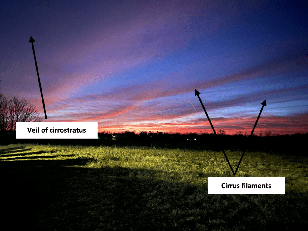
H7 – Cirrostratus covering the entire sky
Once cirrostratus has finished “invading” the sky, it is referred as a veil of high clouds. Generally, the cirrostratus is thin enough to allow sunshine or moonshine to be visible, but if it continues to thicken, it can become opaque and obscure the entire sky.
A cirrostratus veil often marks a process in which the moisture throughout the atmosphere is increasing, and it is not unusual for altostratus to begin to appear shortly after the cirrostratus covers the entire sky. During the cool season (October through April), cirrostratus can be indicative of steady precipitation with 24 hours, but during the warm season, it is not certain rain follows cirrostratus. The cirrostratus in this image (which was taken over north Harrisburg PA) was thin enough to allow sunshine at times.
H8 – Veil of cirrostratus not covering the sky
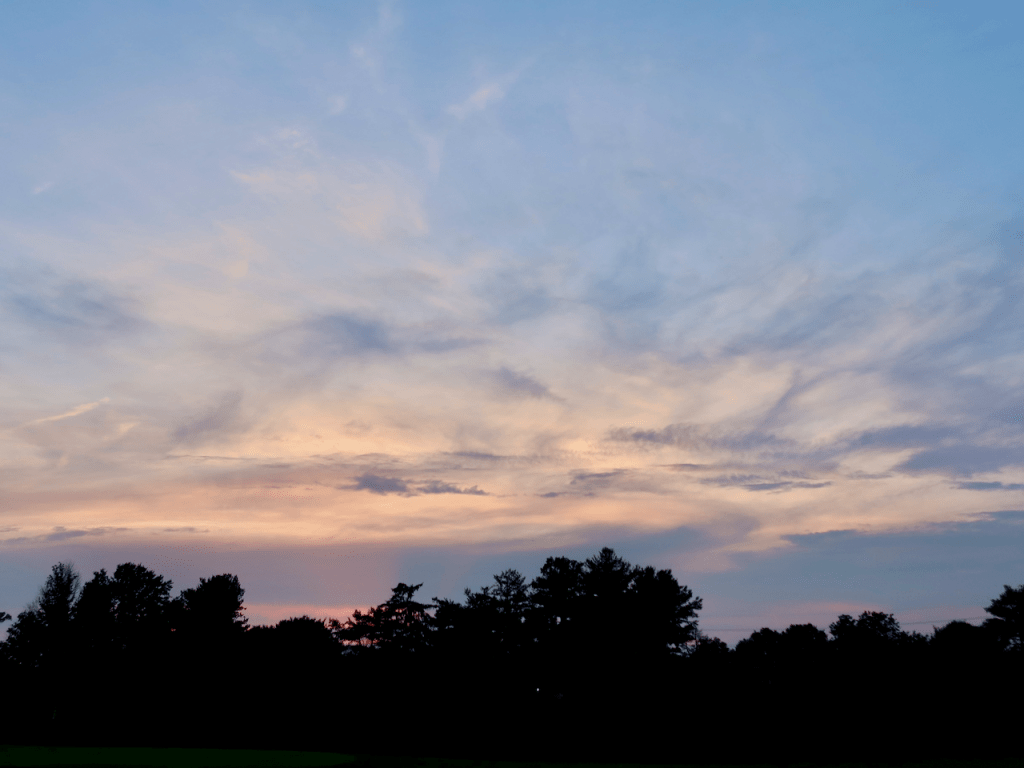
Cirrus clouds remaining relatively stable with respect to sky cover (not covering the whole sky) and not increasing in coverage does not necessarily indicate any imminent change to the weather. This is most likely because the moisture feeding the cirrus development is not increasing or that the lift associated with a jet streak has not increased significantly.
The cirrostratus (along with filaments of cirrus) in this image was captured over Skyline View PA just after sunset. Refraction from the sun (which had set about 45 minutes earlier) continued to illuminate the cirrus and cirrostratus.
H9 – Cirrocumulus
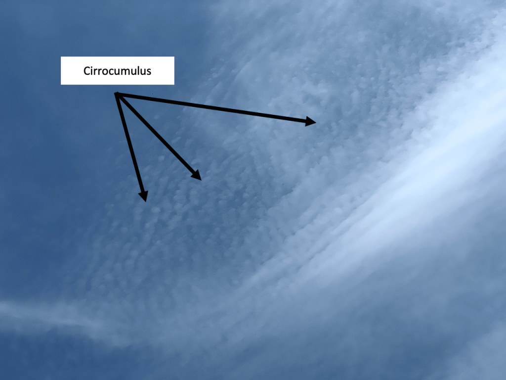
Instability in the higher levels of the atmosphere sometimes manifests itself as small puffy clouds at or above 20,000 feet. Known as cirrocumulus, they resemble cumulus or altocumulus, but are generally much smaller in size. Though the presence of instability in the higher levels can be represented by cirrocumulus, the amount of instability at that level does not mean that any significant weather is imminent.
Cirrocumulus is a relatively rare sighting, as instability sufficient to cause these cloud types to form is not often observed. The cirrocumulus in this image is surrounded by cirrus, but are still instantly recognizable, despite their small size.
(Photo credit: Jeff Hayes)

Leave a comment