Overview
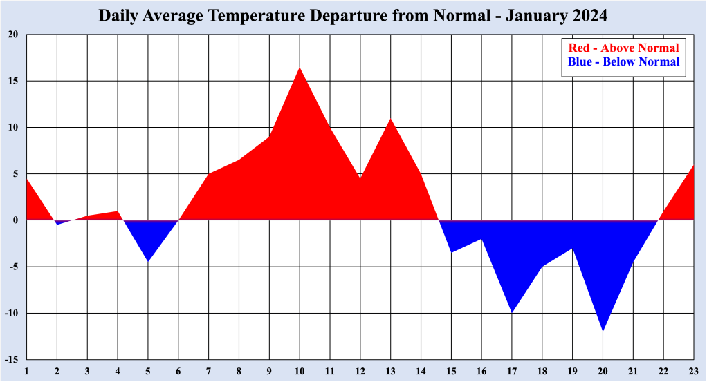
Thus far, January 2024 has produced a wide variety of weather conditions along the NJ coast. First, warm temperatures produced near record high temperatures into the middle part of the month, followed by a week of the the coldest weather since February 2023. Finally, many places on the Jersey Shore received their first measurable snow since 2022. However, the only constant so far this month has been wet conditions, whether in the form of rain or snow.
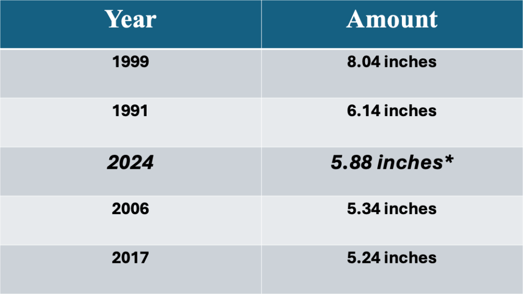
In the Bellcrest section of Toms River, NJ, 5.88 inches of rainfall has been recorded (which includes rainfall as well as melted snow) so far in January 2024. This monthly rainfall makes January 2024 the third wettest January on record at this location (rainfall records extend back to 1989), trailing only the 8.09 inches that fell in January 1999 and 6.14 inches measured in 1991. With the prospect of more rain through the weekend, it is possible that January 2024 could become the second wettest January of record, but it appears highly unlikely that the all-time record for the month will be eclipsed.
Wet Weather Expected into this Weekend
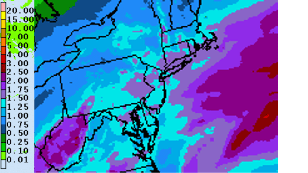
Two areas of low pressure riding along a stationary front south of the region will bring successive slugs of rain to the Jersey Shore through this weekend. The first is expected through Thursday night. While the occasional rain persists through this time, it is not expected to be heavy. Toss in drizzle and fog, and the weather conditions will be deary, though high temperatures Thursday are expected to jump into the mid to upper 50s, which is 15 to 20 degrees above normal for the end of January.
Despite the wet conditions Friday, high temperatures are also expected to rebound into the mid to upper 50s along the Jersey Shore. In fact, high temperatures both days could flirt with record high temperatures for the respective dates. Record high temperatures this time of year are at their lowest, since we are in what is typically the coldest part of the winter for the NJ coast.

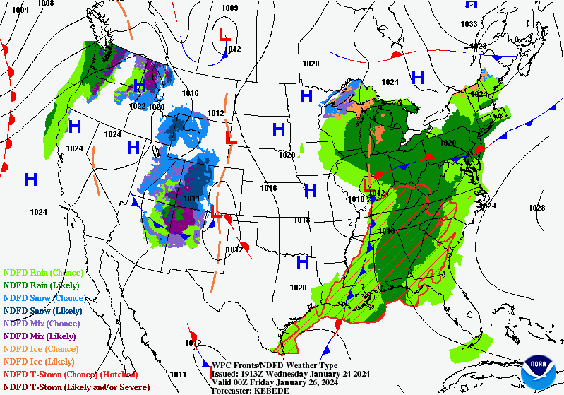
Weak high pressure building across the Northeast will provide a brief respite from the rain, and Saturday could feature sunshine in the morning, which becomes filtered by lowering and thickening clouds. Dry conditions will be short-lived, as low pressure system developing over the southern US sends another area of rain toward the region. Saturday night and Sunday look wet, along with cooler temperatures across the area. Rain could be heavy at times, especially during Sunday afternoon. The additional rainfall could cause small rivers and streams to swell once again, but flooding is NOT expected.
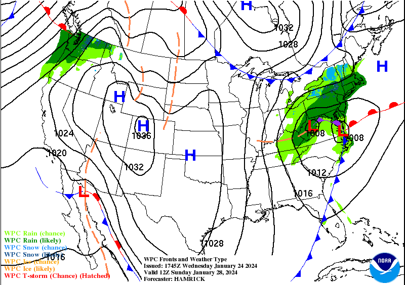
As the low pressure system moves off the coast Sunday night, partly sunny skies return Monday, and temperatures drop back closer to normal for the tail end of January. The additional rainfall could push the monthly total for the Bellcrest section of Toms River toward record values.

Leave a comment