Even as the cleanup from the light to moderate snowfall across the Jersey Shore Monday night into Tuesday continues, there appears to be one more shot of snow with the cold air currently in place Thursday night into Friday afternoon. Beyond that time, cold and dry conditions this weekend slowly warm for the beginning of next week.
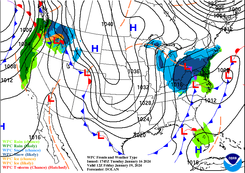
Cold high pressure parked over the northern Gulf Coast states will dominate Wednesday into Thursday across the Jersey Shore, bringing with it below normal temperatures and mainly clear skies. As low pressure approaches from the Great Lakes late Thursday, clouds increase, and light snow is expected to break out from west to east late Thursday night into Friday morning.
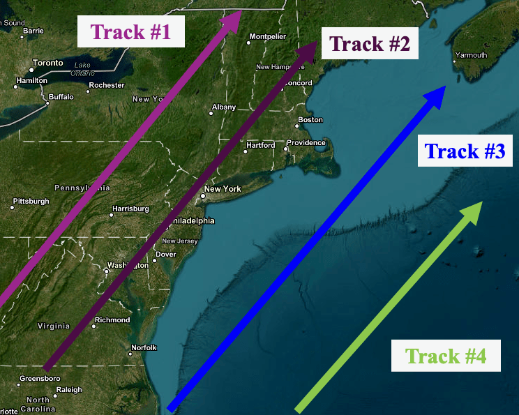
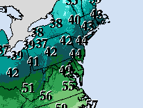
As low pressure over western PA weakens, another low pressure system is expected to develop off the NJ coast before it tracks northeast. Right now, the newly developing storm is expected to take a path similar to that of Track 3, which often favors a mainly snow event for the Jersey Shore. However, it is possible along the immediate coast from Atlantic City to just southeast of Toms River, the snow could mix with or change to rain for a time, before changing back to snow before ending.
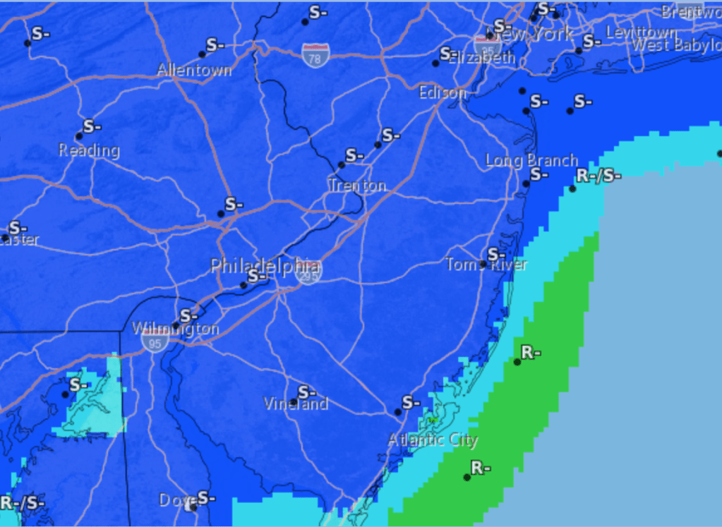
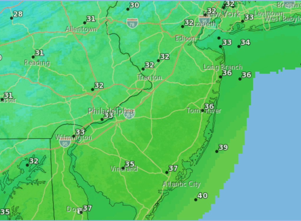
Since the newly developing storm should be moving quickly, there is not much time for moisture to cover the region. From this distance, it appears as though snowfall amounts along the Jersey Shore could be about the same that was received Monday night into Tuesday, especially away from the immediate coast. High temperatures Friday probably occur before noon, then drop back below the freezing mark during the afternoon.
Following the snow Friday, strong high pressure building across the region from the northern Plains brings breezy and cold conditions Saturday, with high temperatures 10 to 15 degrees below normal. The airmass begins to moderate Sunday as the high pressure system moves off the Mid Atlantic coast, then southwest winds bring high temperatures 5 to 10 degrees above normal during the beginning of next week. A change in the overall weather pattern could result in the possible snow Friday being the last snowfall until at least the last week of January.

Leave a comment