As the current weather system wraps up early Wednesday, yet another strong low pressure system is set to affect the region Friday into Friday night. Like the system affecting the area into Wednesday morning, this next storm system is expected to produce mainly rain, as high temperatures Friday and Saturday climb into the 40s and 50s. To put these temperatures into perspective, normal high temperatures along the Jersey Shore are in the lower to mid 40s, meaning high temperatures on Saturday are expected to be about 10 to 15 degrees above normal for the middle of January.
Another round of deep moisture is drawn northward into the region ahead of the next storm system, which is expected feed showers and possibly a thunderstorm Friday into Friday night. Though the rainfall should not be as heavy as the most recent system, any additional rainfall could produce new flooding, or aggravate flooding that is already ongoing. Portions of central and northern NJ could be most vulnerable to flooding, as the next round of heavy rain falls on saturated ground.
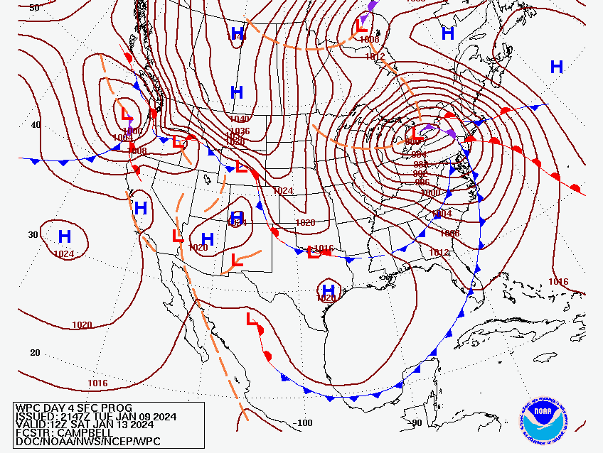
Finally, south to southwest winds will increase in strength and become gusty late Friday into Friday night. Figure 4 below shows the anticipated position of the next strong surface low over western NY state Friday into Friday night. Note the concentric brown lines surrounding the surface low. Those lines are called isobars, and they represent line of constant surface pressure. In general, when isobars are more tightly packed together, associated winds are stronger.
While winds do not look to be quite as strong as the most recent low pressure system, winds could gust in excess of 40 mph once again Friday into Friday night. Winds this strong might result in a few downed tree limbs and possible power outages.
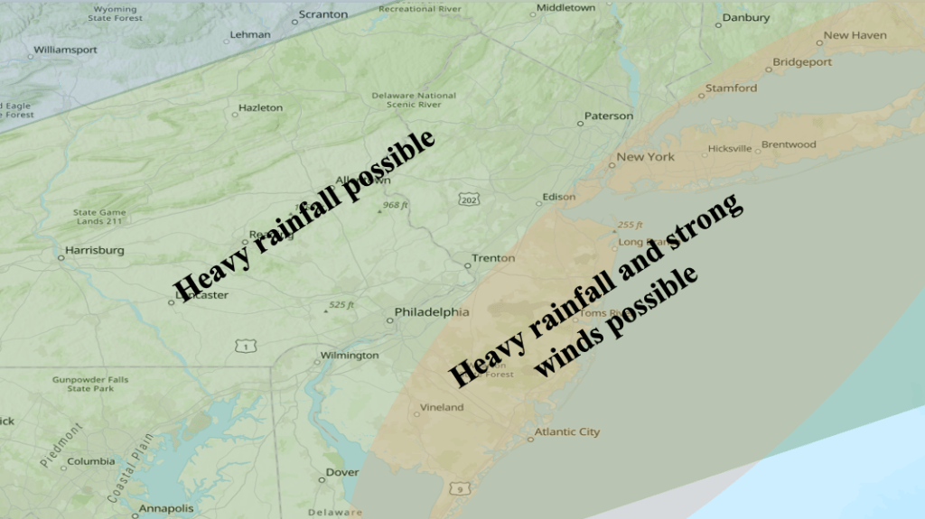
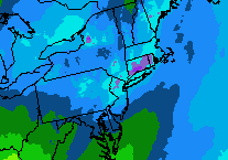
Figure 5 Map of expected weather conditions with the next low pressure system Friday into Friday night. Another round of heavy rainfall and strong winds is possible for the Jersey Shore.
Figure 5 shows the possible weather impacts of the upcoming storm. Along the Jersey Shore, the main weather impacts should be heavy rainfall and strong winds, both affecting the region Friday into Friday night. As mentioned earlier, temperatures ahead of the low pressure system are expected to be much too warm for snow across the entire area.

Leave a comment