As the current weather system wraps up Sunday, another strong low pressure system is set to affect the region Tuesday into Wednesday. Unlike the system this weekend, warmer temperatures are expected across much of the northern Mid Atlantic into southern New England. Warmer temperature suggest that only the higher terrain might see precipitation start as now across northwest NJ and northeast PA, but even in these areas, a change to rain is anticipated.
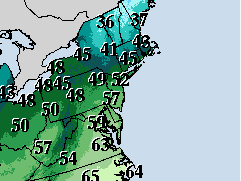
South to southwest winds are expected to draw much warmer air to the Jersey Shore Tuesday afternoon. High temperatures into the 50s will be common, with slightly cooler temperatures along the immediate coast, as cooler ocean water temperatures could limit the warmth here. Normal high temperatures for January 9th in Toms River, NJ is 42 degrees, meaning Tuesday could see temperatures 10 to 15 degrees above norma.
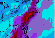
Ahead of the strong low pressure system affecting the Great lakes Tuesday into Wednesday, deep moisture is drawn northward into NJ, which will feed areas of rain and possibly a thunderstorm or two, with the heaviest rain expected late Tuesday afternoon into Tuesday night. A large portion of NJ/PA/NY into southwest New England could receive between 2 and 4 inches of rain, much of which could fall in a short time period. The additional rainfall, falling on ground that remains wet from previous rainfall, may result in some flooding issues along the Jersey Shore (such as street flooding, as well as minor flooding on small river and streams). More widespread flooding is possible across central and northern NJ, where larger river flooding could occur. The National Weather Service has issued a Flood Watch for NJ and much of eastern PA.
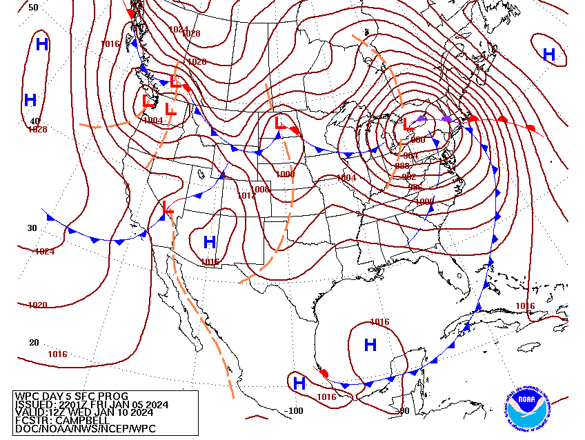
Strong south to southwest winds are also possible, mainly from late Tuesday afternoon into Tuesday night along the NJ coast. Figure 4 shows the anticipated position of the surface low producing strong winds over western Lake Ontario Wednesday morning. Note the concentric brown lines surrounding the surface low. Those lines are called isobars, and they represent line of constant surface pressure. In general, when isobars are more tightly packed together (as they are in Figure 4), winds associated with the low pressure system are stronger. Isobars packed as tightly as shown in this maps may produce wind gusts in excess of 40 mph, particularly along the immediate coast, and the higher terrain across northwest NJ and northeast PA.
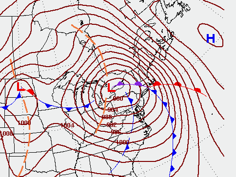
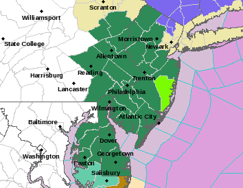
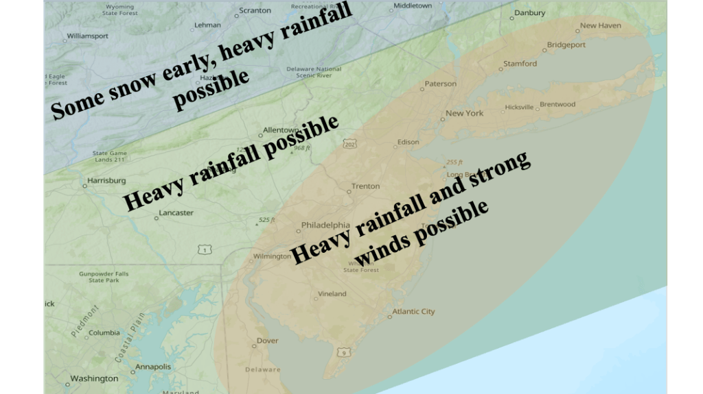
Figure 6 shows the possible weather impacts of the upcoming storm Tuesday into Wednesday. Along the Jersey Shore, the main weather impacts should be heavy rainfall and strong winds, both affecting the region late Tuesday afternoon into Tuesday night. As mentioned earlier, temperatures ahead of the low pressure system are expected to me much too warm for snow, except perhaps across the higher terrain of northwest NJ and northeast PA as the precipitation commences.

Leave a comment