Update – Wednesday afternoon January 3rd 2024
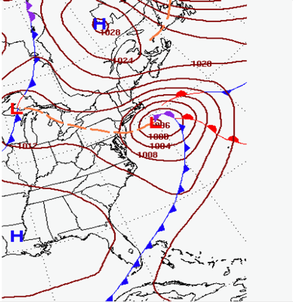
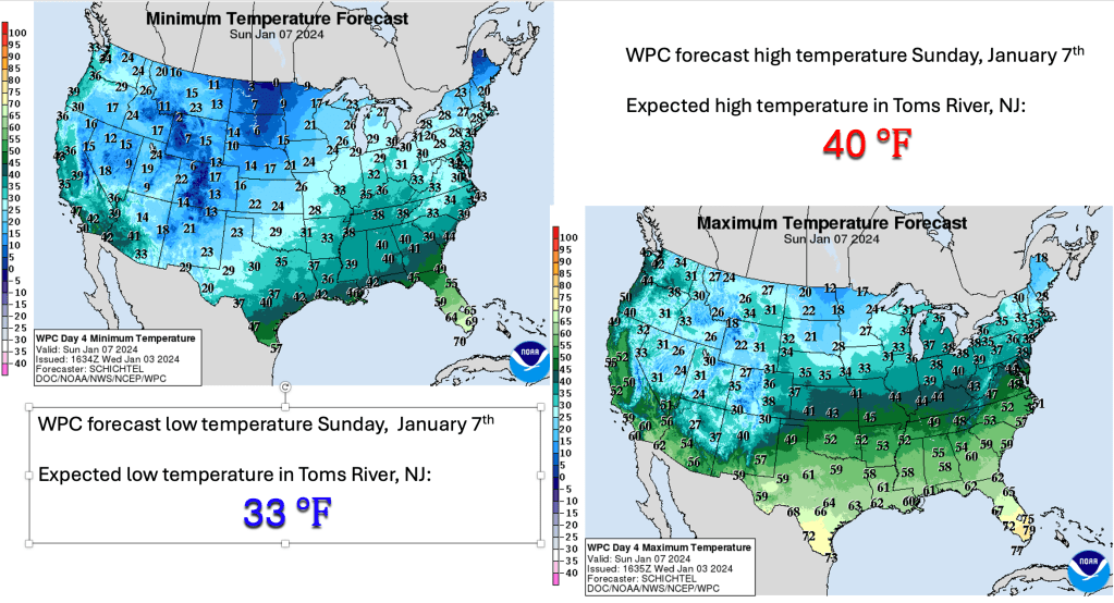
Colder air building across the mid Atlantic and Northeast late this week will set the stage for wintry weather across much of the region this weekend. In fact, many places could see their first accumulating snow of the season, but at this point, it remains unclear how much snow (if any) the Jersey shore will see before mixed precipitation changes to rain overnight Saturday into early Sunday morning.
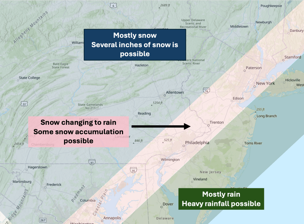
Ahead of the surface low, winds shift from the northeast to the east, allowing milder air to spread across much of the coastal plain of NJ Saturday afternoon and evening. As the precipitation overspreads the the Jersey Shore Saturday evening, it may be cold enough to allow most areas to see a brief period of snow, but at this juncture, it appears unlikely that places along the coast (like Toms River) will receive an inch of snow before the milder air coming in from the ocean changes the snow to rain. After the changeover occurs, heavy rainfall is possible along the coast before the rain ends Sunday morning.
Further inland (generally south and east Interstate 95), where the cold air will remain entrenched longer, a period of snow is likely Saturday evening, and a couple of inches of snow is possible. Even here, as milder air slowly creeps into the region, the snow will mix with or even change to rain late Saturday night or early Sunday morning.
As the surface low pressure system pulls away Sunday, precipitation is expected to end from west to east. Travel could remain slick away from the coast for much of the day, so this could impact travel for the end of the weekend. Looking ahead, another storm is expected to affect the region early next week. From this distance, it appears the storm will track north and west of NJ, meaning that warmer air drawn north into the Jersey Shore will result in a rain event. However, the rain could be heavy, accompanied by strong winds. Stay tuned.

Leave a comment