Thus far this winter, our weather has been wet and warm, with December 2023 providing the 6th warmest December on record in the Bellcrest section of Toms River, NJ (where temperature records date back to 1978) and the 5th wettest December on record (rainfall records extend back to 1989). While there have been a few flakes in the air so far this season, the Jersey Shore has yet to see its first accumulating snow. Snow lovers know that it is not unusual for the first snow of the season to occur in January, especially during the last 10 years.
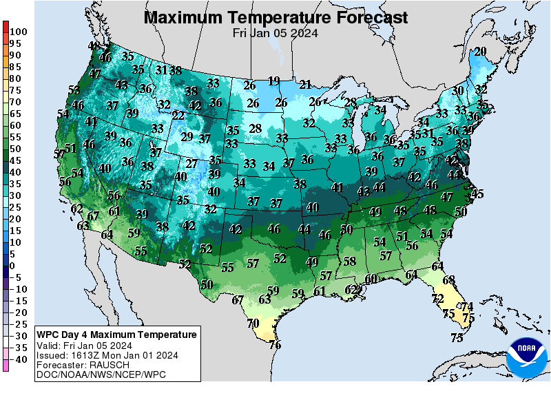
However, the weather pattern is changing. Sunshine and progressively colder temperatures are expected this week, with highs only in the 30s by Friday. High pressure building across Quebec and northern New England will continue to funnel colder air into NJ into the upcoming weekend, setting the stage for the possibility of accumulating snow late Saturday night into Sunday.
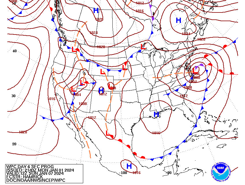
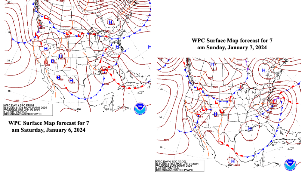
A low pressure system developing along the northern Gulf Coast states Saturday morning is expected to track northeast, reaching a position along the lower DelMarva Peninsula Sunday morning, before moving out into the Atlantic by Sunday evening (Figure 3). Typically, this would be a favorable track for snow along the NJ coast, as high pressure over Quebec feeds cold air south into the region. In this case, though, as the low pressure system strengthens, winds are expected to shift to the east, drawing milder air off the Atlantic into the region.
Before the precipitation with the storm begins, the air above the surface is expected to be fairly dry. As the precipitation falls at the start, it is expected to drag colder air down with it, allowing the precipitation to start as snow, even at the coast. Once the surface wind veers to the east, it will begin to tap the warmer air offshore, warming temperatures near the coast above freezing, possibly changing the snow to rain. Ocean water temperatures are currently in the mid to upper 40s, and this air would be drawn onshore ahead of the developing low pressure system.
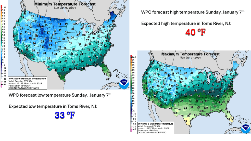
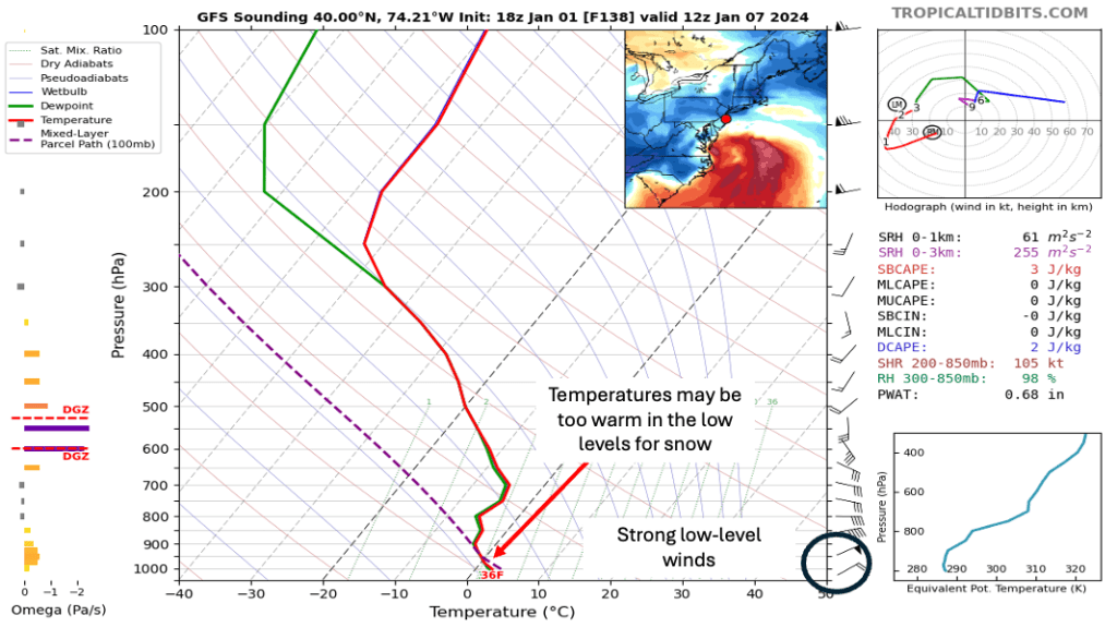
Though the system is nearly a week away, the pattern suggests that warmer temperatures along the coast would result in a mostly rain event for the Jersey Shore, especially from coastal Ocean county south. So, at this distance, the odds of Toms River seeing its first accumulating snow are quite low. Figure 5 shows a model sounding near Toms River at 7 am Sunday, January 7th. A sounding is a meteorological tool that shows temperatures, moisture and wind at different levels in the atmosphere. In this image, the Global Forecast System (GFS) model shows the freezing level about 1,000 feet above the surface. Any snow falling into this layer would change to rain, and the black circle on the bottom right hand portion of the sounding indicate strong east northeast winds, which would suggest that temperatures would remain above freezing through the strongest part of the storm.
There is good model agreement (at this distance) to indicate a strong storm with heavy precipitation centered on Sunday, January 7th will affect the region. Closer to the coast, the precipitation is expected to fall primarily in the form of rain, with between 1 and 2 inches of rain possible. However, further inland, especially across portions of northern and western NJ into eastern PA, there is the potential for a decent amount of snowfall.
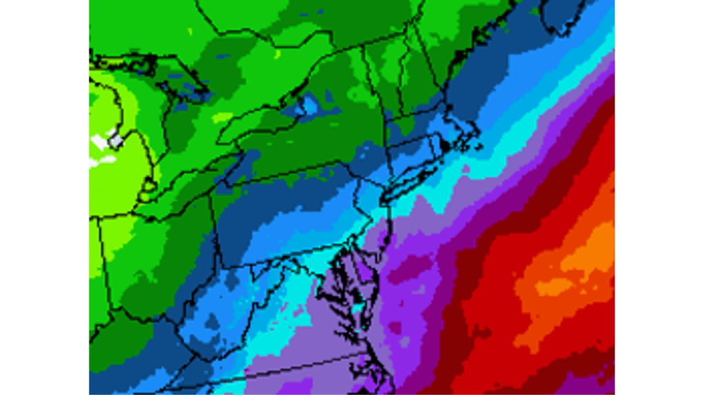
Figure 6 WPC forecast of precipitation for the late weekend event. Where rain is the dominant precipitation type, between 1 and 2 inches of rain is possible.
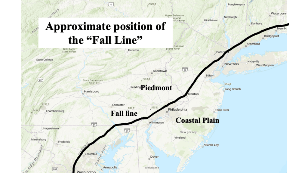
When the surface flow comes the east across NJ during the winter, warmer air tends to flood the coastal plain (generally south and east of Interstate 95, or the New Jersey Turnpike), resulting in a mainly rain event. Northwest of this line, elevation rises gradually. Higher elevations tend to hold onto cold air longer than the coastal plain, meaning more of the precipitation falls as snow.
The line is often referred to as the “Fall Line”, the demarcation line between warmer temperatures to the southeast and a slower change to snow northwest. This line is well known to forecasters in the area, and it often used as a first guess as to the placement of the heavier snowfall when a change to rain might occur. As the event gets closer, more detail can be added to the forecast, but “Fall Line” generally serves as a good place to start when discussing the placement of heavy snow.
To snow lovers (like myself): this event is still six days away, and as we well know, changes in model forecasts can increase or decrease the snowfall potential for the Jersey Shore. There is still a (small) chance that the cold air remains in places longer than expected, allowing for at least some accumulating snow before any changeover can occur.

Leave a comment