Overview
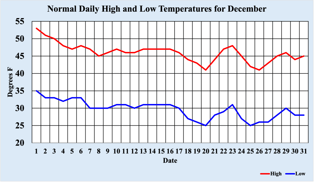
Typically December is the third coldest month of the year (behind January and February) in the Bellcrest section of Toms River, NJ. During the early part of the month, high temperatures average just above 50 degrees F, but drop into the mid 40s by the New Year. Low temperatures generally breach the freezing marking the first week of December, bottoming out in the mid 20s by the end of the month. Of course, these are simply averages, and plenty of variation can and do occur. An earlier blog post covered the record cold December of 1989, when temperatures averaged almost 15 degrees below normal. In this entry, the warmest December on record at this location (temperature records span back to 1978) is discussed.
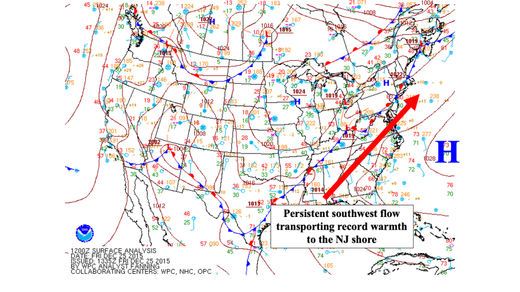
Unlike a “normal” December, high pressure at the surface into the mid levels of the atmosphere remained in place over the Southeast US. This pattern, often referred to as a Bermuda High, kept a southwest flow of warm and humid air flowing into the mid Atlantic states for much of the month, as well as bottled up any arctic air over northern Canada. While there were fluctuations in the pattern in the mid levels (which is expected even in highly anomalous events), for much of the month of December, the flow was more reminiscent of late summer than early winter.
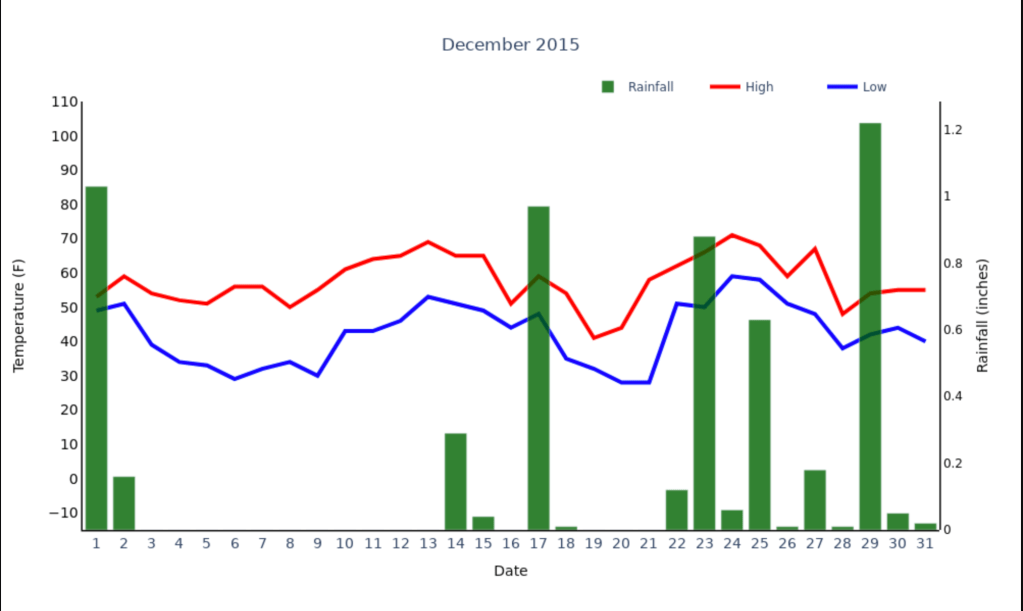
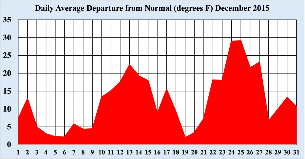
In total, six new daily record high temperatures were established during December 2015, with half of these occurring in the days around Christmas. Even more impressive was the number of record high minimum temperatures set during the month. Sometimes referred to as “maxi mins“, these values represent the warmest low temperatures recorded for these days. An astounding 11 “maxi mins” were recorded for this month. To give these temperatures some perspective, most of the record warm low temperatures were higher than the normal high temperature for that day! In fact, every day of the month had an average temperature above normal, a testament to the persistent warmth through the end the year.
Creating a Record Warm December
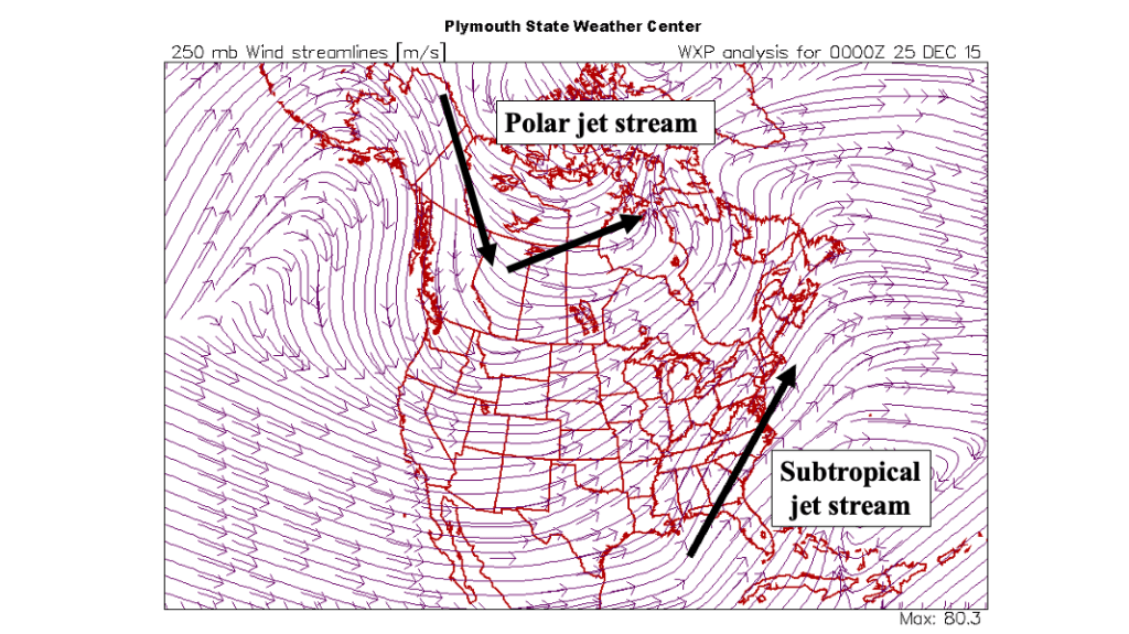
Overall, meteorological fall of 2015 (defined as September, October and November) was warmer than normal in the Bellcrest section of Toms River, NJ, as a summerlike pattern persisted through the autumn. Often the flow in the mid levels of the atmosphere presages the upcoming long term weather. Figure 4 shows the pattern well. The main feature across the eastern US is the ridge of high pressure extending offshore of the Southeast and Mid Atlantic coasts.
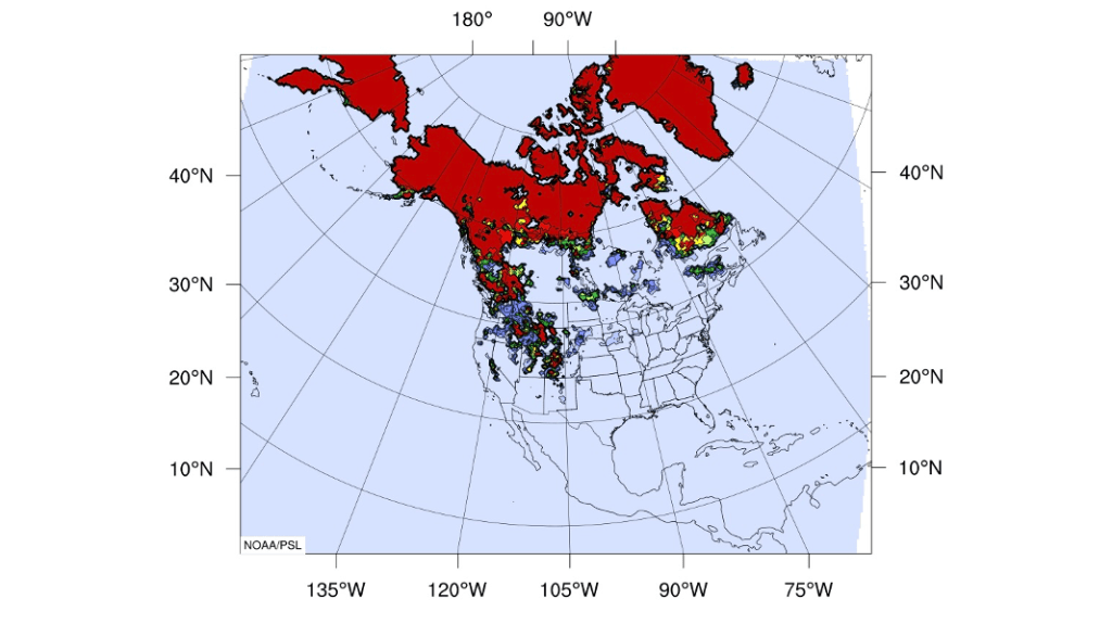
This feature was persistent during the month, pumping warm air into NJ while keeping the arctic air across northern Canada, and the flow was entrenched by the beginning of December 2015. High pressure off the East Coast essentially kept the arctic air building up over the pole from advancing southeast. Once the pattern became established, it prevented normal snow cover to expand across Canada into the northern US. Less snow cover across Canada means that the air that originates there interacts with the bare ground, which tends to warm the air due to friction. So, feedback between conditions at the surface and in the mid levels of the atmosphere combined to create warmer than normal temperatures for a large part of the Northeast and Mid Atlantic states.
Record Warm Christmas
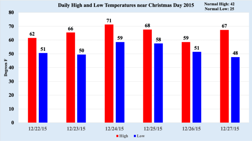
While the entire month of December 2015 was much warmer than normal, there were two distinct periods of record setting temperatures during the month. The first spanned the 12th through the 17th, during which time three daily record highs were eclipsed, as were four record high low temperatures. The second period of extraordinary warmth extended from the 23rd through the 27th, punctuated by near-record warm Christmas Day. Unlike the first warm spell, this period of record temperatures was accompanied by humid conditions (much more like May than December), prompting residents along the East Coast to employ air conditioning while celebrating Christmas!
Between December 23rd and December 27th, three daily record highs were established, and five new record high minimums were set. The warmest day of the streak was Christmas Eve, featuring a new daily record high AND a new record high minimum temperature. In fact, these temperatures are more like those experienced in May than the end of December. As a front boundary sagged south across New England into the Mid Atlantic states, temperatures began to cool, and brought with it showers and thunderstorms. Needless to say, there was not a white Christmas anywhere along the East Coast, but the month concluded with temperatures closer to normal for the season.
Review
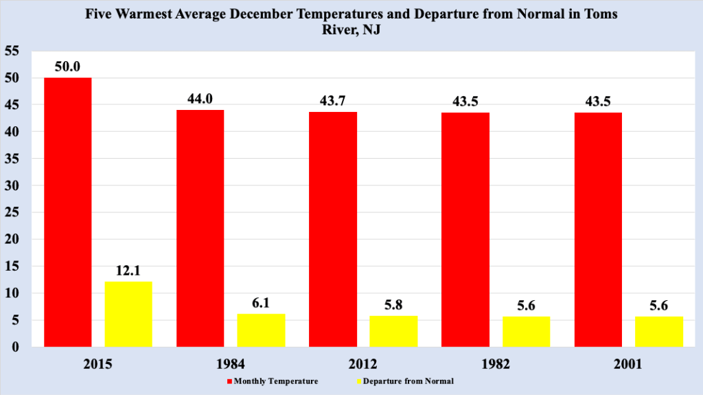
December 2015 was the warmest December on record in the Bellcrest section of Toms River, NJ (where temperatures records extend back to 1978), featuring two periods of extraordinary warmth for early winter. In fact, December 2015 average temperature was a remarkable 12 degrees above normal, and six degrees warmer than the second warmest December on record. A persistent pattern extending from the surface through the mid levels of the atmosphere established itself during the Fall of 2015, setting the stage for nearly unprecedented warmth across the entire eastern US. The peak of the warmth occurred in the days surrounding Christmas, with several record temperatures recorded, with temperatures returning closer to normal to end the year.

Leave a comment